Area Overview for B28 8NR
Photos of B28 8NR
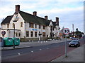
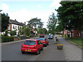
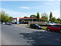
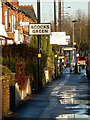
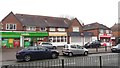
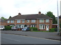
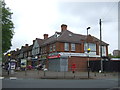
27 photos from this area
Area Information
Key information about the B28 8NR including its size, population, and administrative classification.
- Area Type
- Postcode
- Area Size
- 1.0 hectares
- Population
- 1830
- Population Density
- 4953 people/km²
House Prices in B28 8NR
12
Properties
£212,921
Average Sold Price
£90,000
Lowest Price
£312,500
Highest Price
Showing 12 properties
| Address | Type | Beds | Baths | Last Sale Price | Last Sale Date | |
|---|---|---|---|---|---|---|
| 21 Lulworth Road, Birmingham, B28 8NR | Semi-detached | 3 | 1 | £312,500 | Mar 2022 | |
| 11 Lulworth Road, Birmingham, B28 8NR | house | - | - | £279,950 | Jun 2021 | |
| 19 Lulworth Road, Birmingham, B28 8NR | Semi-detached | 3 | 1 | £255,000 | Sep 2018 | |
| 15 Lulworth Road, Birmingham, B28 8NR | house | 3 | 1 | £180,000 | Mar 2012 | |
| 17 Lulworth Road, Birmingham, B28 8NR | Semi-detached | 3 | 1 | £178,000 | Sep 2010 | |
| 23 Lulworth Road, Birmingham, B28 8NR | house | - | - | £195,000 | Jan 2006 | |
| 7 Lulworth Road, Birmingham, B28 8NR | Terraced | - | - | £90,000 | Feb 2000 | |
| 18 Lulworth Road, Birmingham, B28 8NR | Detached | 4 | - | - | - | |
| 5 Lulworth Road, Birmingham, B28 8NR | house | 3 | - | - | - | |
| 25 Lulworth Road, Birmingham, B28 8NR | Terraced | - | - | - | - |
Page 1 of 2
Energy Efficiency in B28 8NR
Amenities
Schools
| Rank | School | Type | Entry gender | Ages |
|---|
Explore more schools in this area
Go to Schools tabDemographics
Household Size
Family (3-5 people)
most common
Accommodation Type
Houses
most common
Tenure
65
majority
Ethnic Group
asian_total
most common
Religion
N/A
most common
Household Composition
N/A
most common
Age
47
median
Adults (30-64 years)
most common
Household Deprivation
N/A
with no deprivation
NS-SEC
25
in Lower managerial occupations
Explore more demographic insights in this area
Go to Demographics tabPlanning
Planning Constraints
- Flood RiskPremium
- Ramsar Wetland SitesPremium
- Area of Outstanding Natural BeautyPremium
- Protected Nature ReservePremium
- Protected WoodlandPremium