Area Overview for B28 8NH
Photos of B28 8NH
Area Information
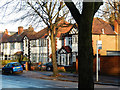
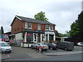
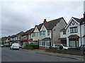
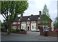
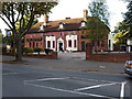
B28 8NH is a small, residential postcode area nestled in southeast Birmingham, part of the broader Hall Green district. With a population of 1,885, it is a compact community defined by its suburban charm and historical character. The area features low-rise housing from the early 20th century, interwar periods, and later developments, often set back from roads with tree-lined streets and red brick boundary walls. Hall Green is recognised as one of Birmingham’s safer districts, with employment rates slightly above the city average and lower unemployment than the surrounding areas. Daily life here blends quiet residential living with access to nearby amenities, including retail, rail, and metro connections. The area’s heritage is evident in landmarks like the 1704 Church of the Ascension and the Victorian Friends Meeting House, which reflect its Quaker roots. For buyers seeking a mix of historical significance, safety, and practicality, B28 8NH offers a distinct suburban experience with a strong sense of community.
- Area Type
- Postcode
- Area Size
- Not available
- Population
- 1885
- Population Density
- 6711 people/km²
The property market in B28 8NH is characterised by a high rate of home ownership, with 76% of properties occupied by their owners. This suggests a predominantly owner-occupied market, where residents are likely to have long-term commitments to the area. The accommodation types are largely houses, reflecting a traditional suburban layout that caters to families and individuals seeking spacious, established homes. Given the small size of the postcode area, the housing stock is limited, making it a niche market for buyers seeking specific properties. The presence of historic homes, such as the early 20th-century villas in The Hamlet development, adds to the area’s appeal. However, the limited number of properties means that buyers should consider nearby areas for broader options. The market is likely to be competitive, with demand driven by the area’s safety, heritage, and proximity to amenities.
House Prices in B28 8NH
No properties found in this postcode.
Energy Efficiency in B28 8NH
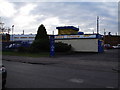
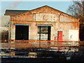
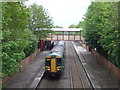
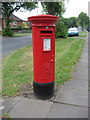
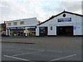
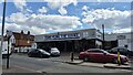
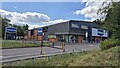
Living in B28 8NH offers a blend of practicality and historical charm. Nearby amenities include five retail outlets, such as Tesco Hall and Aldi Hall, ensuring daily shopping needs are met. The area’s proximity to five railway stations, including Hall Green and Spring Road, provides easy access to Birmingham’s transport network. Metro stops like Corporation Street and Bull Street further connect residents to the city’s commercial and cultural centres. The area’s character is enhanced by landmarks like the Church of the Ascension, a 1704 classical church, and Hall Green Junior School, which dates to 1893. These features contribute to a sense of heritage and community. The tree-lined streets and historic housing create a peaceful environment, while the accessibility to retail and transport ensures convenience for daily life.
Amenities
Schools
| Rank | School | Type | Entry gender | Ages |
|---|
Explore more schools in this area
Go to Schools tabDemographics
The population of B28 8NH has a median age of 47, with the majority of residents aged between 30 and 64. This suggests a community of established adults, likely with families, contributing to a stable and mature demographic profile. Home ownership is high, with 76% of properties occupied by their owners, indicating a strong sense of local attachment. The area is predominantly composed of houses, reflecting a traditional, family-oriented housing stock. The predominant ethnic group is the Asian community, which shapes the cultural and social fabric of the area. While specific deprivation data is not provided, the high home ownership and employment rates imply a relatively stable economic environment. This combination of age, ownership, and diversity creates a cohesive community where residents are likely to have long-term ties to the area.
Household Size
Accommodation Type
Tenure
Ethnic Group
Religion
Household Composition
Age
Household Deprivation
NS-SEC
Explore more demographic insights in this area
Go to Demographics tabPlanning
Planning Constraints
- Flood RiskPremium
- Ramsar Wetland SitesPremium
- Area of Outstanding Natural BeautyPremium
- Protected Nature ReservePremium
- Protected WoodlandPremium