Area Overview for B28 8LF
Photos of B28 8LF
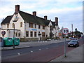
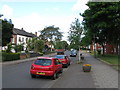
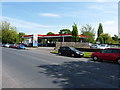
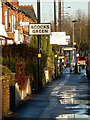
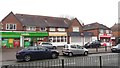
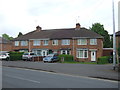
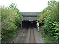
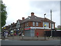
27 photos from this area
Area Information
Key information about the B28 8LF including its size, population, and administrative classification.
- Area Type
- Postcode
- Area Size
- 6611 m²
- Population
- 1652
- Population Density
- 6737 people/km²
House Prices in B28 8LF
24
Properties
£150,375
Average Sold Price
£142,500
Lowest Price
£167,000
Highest Price
Showing 24 properties
| Address | Type | Beds | Baths | Last Sale Price | Last Sale Date | |
|---|---|---|---|---|---|---|
| 162 York Road, Hall Green, Birmingham, B28 8LF | house | - | - | £167,000 | Mar 2021 | |
| 168 York Road, Hall Green, Birmingham, B28 8LF | house | - | - | £143,000 | Feb 2016 | |
| 158 York Road, Hall Green, Birmingham, B28 8LF | house | - | - | £142,500 | Jun 2014 | |
| 170 York Road, Hall Green, Birmingham, B28 8LF | house | - | - | £149,000 | Feb 2008 | |
| 154 York Road, Hall Green, Birmingham, B28 8LF | house | 4 | 2 | - | - | |
| 167A York Road, Hall Green, Birmingham, B28 8LF | Flat | 1 | 1 | - | - | |
| Flat 1, 160 York Road, Hall Green, Birmingham, B28 8LF | Flat | 1 | 1 | - | - | |
| Flat At, 169 York Road, Hall Green, Birmingham, B28 8LF | Flat | - | - | - | - | |
| Flat At, 165 York Road, Hall Green, Birmingham, B28 8LF | Flat | - | - | - | - | |
| Flat At, 157 York Road, Hall Green, Birmingham, B28 8LF | Flat | 1 | 2 | - | - |
Page 1 of 3
Energy Efficiency in B28 8LF
Amenities
Schools
| Rank | School | Type | Entry gender | Ages |
|---|
Explore more schools in this area
Go to Schools tabDemographics
Household Size
One person
most common
Accommodation Type
Houses
most common
Tenure
40
majority
Ethnic Group
White
most common
Religion
N/A
most common
Household Composition
N/A
most common
Age
47
median
Adults (30-64 years)
most common
Household Deprivation
N/A
with no deprivation
NS-SEC
17
in Lower managerial occupations
Explore more demographic insights in this area
Go to Demographics tabPlanning
Planning Constraints
- Flood RiskPremium
- Ramsar Wetland SitesPremium
- Area of Outstanding Natural BeautyPremium
- Protected Nature ReservePremium
- Protected WoodlandPremium