Area Overview for B28 8HR
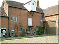
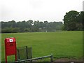
Photos of B28 8HR
Area Information
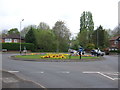
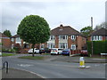
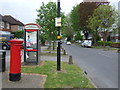
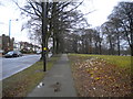
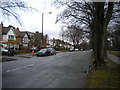
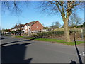
B28 8HR is a small, tightly knit residential postcode area in southeast Birmingham, forming part of the broader Hall Green district. With a population of 1,819, it reflects a suburban character defined by early 20th-century housing, tree-lined streets, and low red brick boundary walls. The area is notable for its safety, with below-average crime rates and no flood risk, making it a stable choice for long-term living. Hall Green North Ward, which includes B28 8HR, is a historic district with roots in late 19th-century developments like The Hamlet, a collection of 14 villas built between 1883 and 1893. Today, the area balances residential tranquility with proximity to Birmingham’s urban amenities, including railway stations, retail hubs, and cultural landmarks. Its blend of heritage and modern convenience appeals to those seeking a secure, community-focused environment without sacrificing access to city life.
- Area Type
- Postcode
- Area Size
- Not available
- Population
- 1819
- Population Density
- 4595 people/km²
B28 8HR is primarily an owner-occupied area, with 80% of homes owned by residents rather than rented. The accommodation type is exclusively houses, with no flats or apartments listed, suggesting a focus on family-friendly, detached or semi-detached properties. This aligns with the area’s historical development, which includes early 20th-century housing and interwar-era homes. The small postcode area likely has limited housing stock, meaning buyers should consider nearby suburbs for more options. The high home ownership rate indicates stability, but the absence of rental properties may limit flexibility for those needing short-term housing. For buyers, this area offers a mix of heritage architecture and modern living, though the narrow focus on houses may appeal more to families than to investors seeking diverse property types.
House Prices in B28 8HR
No properties found in this postcode.
Energy Efficiency in B28 8HR
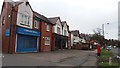
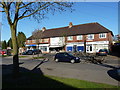
Living in B28 8HR offers access to a range of nearby amenities, including five retail outlets such as Co-op Sparkhill, Tesco Hall, and Waitrose Hall, ensuring daily shopping needs are met. The area’s proximity to Hall Green Railway Station and other stations connects residents to Birmingham’s cultural and commercial hubs. Historical landmarks like the Church of the Ascension (1704) and the Friends Meeting House (1883) add character, while schools such as Hall Green Junior School provide educational options. Parks and tree-lined streets contribute to a peaceful lifestyle, and the absence of major planning constraints means residents can enjoy a mix of heritage and modern living without restrictions. The blend of retail, transport, and cultural sites creates a convenient, community-focused environment.
Amenities
Schools
| Rank | School | Type | Entry gender | Ages |
|---|
Explore more schools in this area
Go to Schools tabDemographics
The population of B28 8HR is predominantly adults aged 30–64, with a median age of 47. Home ownership is high, at 80%, reflecting a stable, long-term resident base. The area is characterised by houses, with no mention of flats or other property types. The predominant ethnic group is Asian, though specific subgroups are not detailed. The community appears to have lower deprivation levels compared to Birmingham’s average, with employment rates slightly above the city average and unemployment rates below average. This suggests a resilient local economy with strong ties to both historical and contemporary industries. The age profile indicates a mature demographic, likely with established families and professionals, contributing to a quiet, low-traffic residential environment.
Household Size
Accommodation Type
Tenure
Ethnic Group
Religion
Household Composition
Age
Household Deprivation
NS-SEC
Explore more demographic insights in this area
Go to Demographics tabPlanning
Planning Constraints
- Flood RiskPremium
- Ramsar Wetland SitesPremium
- Area of Outstanding Natural BeautyPremium
- Protected Nature ReservePremium
- Protected WoodlandPremium