Area Overview for B28 8EF
Photos of B28 8EF
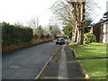
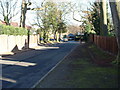
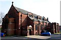
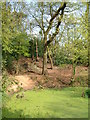
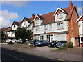
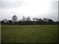
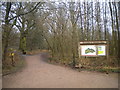
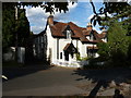
57 photos from this area
Area Information
Key information about the B28 8EF including its size, population, and administrative classification.
- Area Type
- Postcode
- Area Size
- 1.3 hectares
- Population
- 1819
- Population Density
- 4595 people/km²
House Prices in B28 8EF
17
Properties
£212,095
Average Sold Price
£12,000
Lowest Price
£300,000
Highest Price
Showing 17 properties
| Address | Type | Beds | Baths | Last Sale Price | Last Sale Date | |
|---|---|---|---|---|---|---|
| 198 Sarehole Road, Birmingham, B28 8EF | Detached | 3 | 1 | £300,000 | Dec 2025 | |
| 182 Sarehole Road, Birmingham, B28 8EF | Detached | 3 | 1 | £250,000 | Oct 2025 | |
| 176 Sarehole Road, Birmingham, B28 8EF | Semi-detached | 3 | 1 | £264,000 | Sep 2025 | |
| 180 Sarehole Road, Birmingham, B28 8EF | Semi-detached | 3 | 1 | £263,932 | Jun 2024 | |
| 186 Sarehole Road, Birmingham, B28 8EF | Semi-detached | 3 | 1 | £241,000 | Mar 2023 | |
| 194 Sarehole Road, Birmingham, B28 8EF | house | 3 | 1 | £258,500 | Jan 2020 | |
| 190 Sarehole Road, Birmingham, B28 8EF | house | - | - | £226,000 | Dec 2017 | |
| 174 Sarehole Road, Birmingham, B28 8EF | Semi-detached | 3 | - | £173,000 | Jul 2016 | |
| 184 Sarehole Road, Birmingham, B28 8EF | house | - | - | £251,300 | Mar 2016 | |
| 192 Sarehole Road, Birmingham, B28 8EF | house | 3 | - | £155,000 | Jul 2012 |
Page 1 of 2
Energy Efficiency in B28 8EF
Amenities
Schools
| Rank | School | Type | Entry gender | Ages |
|---|
Explore more schools in this area
Go to Schools tabDemographics
Household Size
Family (3-5 people)
most common
Accommodation Type
Houses
most common
Tenure
80
majority
Ethnic Group
asian_total
most common
Religion
N/A
most common
Household Composition
N/A
most common
Age
47
median
Adults (30-64 years)
most common
Household Deprivation
N/A
with no deprivation
NS-SEC
35
in Lower managerial occupations
Explore more demographic insights in this area
Go to Demographics tabPlanning
Planning Constraints
- Flood RiskPremium
- Ramsar Wetland SitesPremium
- Area of Outstanding Natural BeautyPremium
- Protected Nature ReservePremium
- Protected WoodlandPremium