Area Overview for B28 8DZ
Photos of B28 8DZ
Area Information
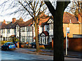
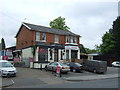
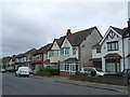
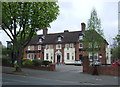
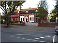
Living in B28 8DZ means inhabiting a small, residential postcode in southeast Birmingham, part of the broader Hall Green area. This ward is characterised by low-rise housing from the early 20th century, interwar period, and later developments, set within tree-lined streets and well-kept gardens. With a population of 1,885, it is a tight-knit community where homes are predominantly owner-occupied, reflecting a stable, long-term resident base. The area’s historical roots are evident in its architecture, from Victorian villas with leaded casements to Art Deco housing blocks. Daily life here balances suburban tranquillity with proximity to Birmingham’s urban amenities. The ward is noted for its safety, with crime rates around the city average, and its blend of residential character with commercial spaces like Cambrai Court. Residents benefit from nearby rail links, retail outlets, and cultural landmarks such as the Friends Meeting House and the Church of the Ascension, which date back to the 18th and 19th centuries. This postcode offers a mix of heritage and modern convenience, ideal for those seeking a settled, community-oriented lifestyle.
- Area Type
- Postcode
- Area Size
- Not available
- Population
- 1885
- Population Density
- 6711 people/km²
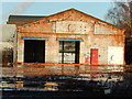
The property market in B28 8DZ is dominated by owner-occupied homes, with 76% of properties owned by residents rather than rented. This suggests a stable market with limited turnover, as the area is not heavily reliant on rental demand. The accommodation type is predominantly houses, reflecting a suburban layout with low-rise, traditional properties. These include early 20th-century villas with red brick walls and tree-lined streets, as well as later infill developments. The presence of Art Deco housing blocks like Petersfield Court adds architectural diversity. Given the small size of the postcode, the housing stock is likely limited, making the area more suitable for buyers seeking established homes rather than investment opportunities. The high home ownership rate also implies that rental options are scarce, which could be a consideration for those prioritising flexibility.
House Prices in B28 8DZ
No properties found in this postcode.
Energy Efficiency in B28 8DZ
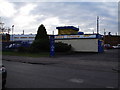
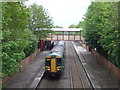
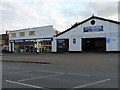
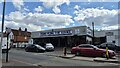
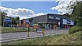
Residents of B28 8DZ have access to a range of amenities within practical reach. Retail options include Tesco Hall, Waitrose Hall, and Lidl Acocks, offering everyday shopping needs. The area’s historical character is evident in landmarks like the Friends Meeting House (built in 1883) and the Church of the Ascension (1704), which add cultural and architectural interest. Nearby schools such as Hall Green Junior School provide education for local families. The presence of multiple rail stations and metro stops ensures easy access to Birmingham’s wider network, supporting both leisure and commuting. The suburban layout with tree-lined streets and historic homes fosters a sense of community, while the blend of retail, transport, and heritage sites contributes to a balanced lifestyle.
Amenities
Schools
| Rank | School | Type | Entry gender | Ages |
|---|
Explore more schools in this area
Go to Schools tabDemographics
The population of B28 8DZ is 1,885, with a median age of 47, indicating a mature demographic skewed towards adults aged 30–64. Home ownership is high at 76%, suggesting a stable, long-term resident base. The accommodation is predominantly houses, reflecting a suburban rather than high-density housing profile. The predominant ethnic group is Asian, which shapes the cultural fabric of the area. This demographic profile implies a community with established roots, where families and professionals coexist. The absence of specific deprivation data means quality of life is inferred from the area’s safety, amenities, and infrastructure. With a median age above the national average, the area may have a lower proportion of young families or students, though this is not explicitly stated. The high home ownership rate also suggests lower rental availability, which could influence housing market dynamics.
Household Size
Accommodation Type
Tenure
Ethnic Group
Religion
Household Composition
Age
Household Deprivation
NS-SEC
Explore more demographic insights in this area
Go to Demographics tabPlanning
Planning Constraints
- Flood RiskPremium
- Ramsar Wetland SitesPremium
- Area of Outstanding Natural BeautyPremium
- Protected Nature ReservePremium
- Protected WoodlandPremium