Area Overview for B28 8BT
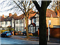
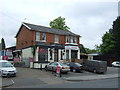
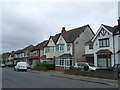
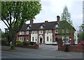
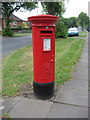
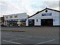
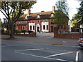
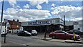
Photos of B28 8BT


Area Information
Living in B28 8BT means settling in a quiet, suburban corner of Birmingham’s Hall Green district, where historic architecture meets modern convenience. This small postcode area, home to 1,995 residents, is part of Hall Green North Ward, a neighbourhood known for its safety and low crime rates. The area’s character is defined by early 20th-century housing, tree-lined streets, and low red brick boundary walls, reflecting its origins as a private development from the 1880s. Residents here are predominantly adults aged 30–64, with a median age of 47, suggesting a stable, family-oriented community. The area’s proximity to Birmingham’s city centre, coupled with its low crime risk and excellent broadband connectivity, makes it appealing for those seeking a balance between suburban tranquillity and urban access. Daily life is shaped by its historic charm, with landmarks like the 1704 Church of the Ascension and the Victorian Friends Meeting House adding cultural depth. The mix of older properties and well-kept gardens offers a distinct living experience, ideal for those valuing both heritage and practicality.
- Area Type
- Postcode
- Area Size
- Not available
- Population
- 1995
- Population Density
- 7202 people/km²
The property market in B28 8BT is characterised by a high proportion of owner-occupied homes, with 65% of residents living in their own properties. This suggests a community of long-term residents rather than a transient rental market. The area’s housing stock is predominantly houses, not flats, reflecting its suburban nature and historical development as a private residential cluster. Many properties date back to the early 20th century, interwar period, or later infill developments, offering a mix of architectural styles from the 1880s to the mid-20th century. This includes features such as red brick facades, timber detailing, and tree-lined streets, which contribute to the area’s distinct character. However, the small size of the postcode area means the housing stock is limited, and buyers should consider the proximity to larger Birmingham districts for more options. The combination of historical charm and practicality makes B28 8BT appealing to those seeking a settled, low-maintenance lifestyle with a strong sense of community.
House Prices in B28 8BT
No properties found in this postcode.
Energy Efficiency in B28 8BT
Life in B28 8BT is shaped by its mix of historic architecture, local amenities, and transport links. The area’s tree-lined streets and early 20th-century housing create a peaceful, residential atmosphere, while nearby retail options like Tesco Hall and Lidl Acocks cater to daily needs. The proximity to three railway stations—Hall Green, Spring Road, and Tyseley—ensures easy access to Birmingham’s broader transport network, and the three metro stations—Grand Central New Street, Corporation Street, and Bull Street—add further convenience for commuting. For cultural and historical interests, landmarks such as the 1704 Church of the Ascension and the Victorian Friends Meeting House offer a glimpse into the area’s heritage. The blend of practicality and character makes B28 8BT ideal for those seeking a balanced lifestyle, with both suburban tranquillity and urban connectivity within reach.
Amenities
Schools
The nearest school to B28 8BT is Yorkmead Junior and Infant School, a primary school with a Good Ofsted rating. This institution serves the local community, offering education for younger children in a setting that aligns with the area’s family-oriented demographics. The absence of secondary schools in the immediate vicinity means families may need to consider nearby districts for secondary education, though the proximity to Birmingham’s city centre could provide alternative options. The presence of a well-rated primary school is a significant draw for families prioritising quality education, particularly given the area’s reputation for safety and stability. The school’s rating suggests a commitment to educational standards, which complements the broader appeal of B28 8BT as a residential hub for those seeking a balanced lifestyle.
| Rank | School | Type | Entry gender | Ages |
|---|
Explore more schools in this area
Go to Schools tabDemographics
B28 8BT’s population of 1,995 is predominantly composed of adults aged 30–64, with a median age of 47. This suggests a mature, established community with a strong presence of middle-aged households. Home ownership stands at 65%, indicating a mix of owner-occupied properties and rental units, though the data does not specify the latter’s proportion. The area’s accommodation is primarily houses, not flats, reflecting a suburban layout rather than high-density living. The predominant ethnic group is Asian_total, though specific subgroups are not detailed. This demographic profile aligns with Hall Green’s reputation as a historically developed area with a blend of long-standing residents and newer arrivals. The absence of detailed deprivation data means no direct claims can be made about economic hardship, but the area’s safety and infrastructure suggest a relatively stable quality of life. The age profile and home ownership figures imply a community focused on stability, with fewer young families or transient populations compared to other parts of Birmingham.
Household Size
Accommodation Type
Tenure
Ethnic Group
Religion
Household Composition
Age
Household Deprivation
NS-SEC
Explore more demographic insights in this area
Go to Demographics tabPlanning
Planning Constraints
- Flood RiskPremium
- Ramsar Wetland SitesPremium
- Area of Outstanding Natural BeautyPremium
- Protected Nature ReservePremium
- Protected WoodlandPremium