Area Overview for B28 8BS
Photos of B28 8BS
Area Information
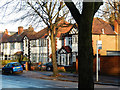
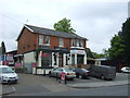
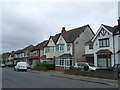
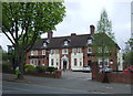
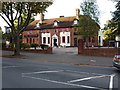
Living in B28 8BS, a small residential postcode cluster in Birmingham’s Hall Green North Ward, offers a blend of suburban tranquillity and historical character. With a population of 1,995, this area is part of a broader district recognised as one of Birmingham’s safest. The neighbourhood features low red brick boundary walls, tree-lined streets, and homes primarily built in the early twentieth century, interwar period, and later infill developments. Residents benefit from a mix of residential architecture and proximity to commercial spaces like Cambrai Court, an Edwardian office block. The area’s charm lies in its well-maintained surroundings, with parks and green spaces contributing to a sense of community. Daily life here is shaped by a mature demographic, with adults aged 30–64 forming the largest group. The postcode’s compact size means amenities and services are within practical reach, while its location in southeast Birmingham provides easy access to the city’s transport networks. For buyers, B28 8BS represents a balance of historical appeal and modern convenience, ideal for those seeking a stable, family-oriented environment.
- Area Type
- Postcode
- Area Size
- Not available
- Population
- 1995
- Population Density
- 7202 people/km²
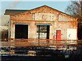
The property market in B28 8BS is characterised by a high rate of home ownership (65%) and a predominance of houses over flats or apartments. This reflects the area’s historical development, with properties dating back to the early twentieth century and interwar periods. The limited size of the postcode means the housing stock is relatively small, with a focus on older, characterful homes. Buyers should expect a market where owner-occupation is the norm, though the availability of rental properties is not specified. The presence of listed buildings like Petersfield Court, an Art Deco housing block, and the Hamlet development’s Victorian villas adds to the area’s appeal for those seeking unique architectural features. However, the compact nature of the postcode means competition for properties may be keen, particularly for homes with historical significance or proximity to amenities.
House Prices in B28 8BS
No properties found in this postcode.
Energy Efficiency in B28 8BS
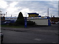
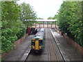
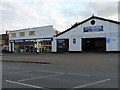
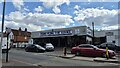
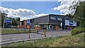
The lifestyle in B28 8BS is enriched by a range of nearby amenities, including retail outlets such as Tesco Hall, Co-op Sparkhill, and Lidl Acocks, which provide everyday shopping needs. The area’s historical character is complemented by cultural landmarks like the Church of the Ascension (1704), the Friends Meeting House (1883), and Hall Green Junior School (1893). These sites reflect the district’s heritage and offer opportunities for community engagement. The presence of rail and metro stations ensures easy access to Birmingham’s cultural and commercial hubs, while the tree-lined streets and low-density housing contribute to a relaxed suburban atmosphere. Residents benefit from a balance of convenience and tranquillity, with amenities that support both daily life and leisure.
Amenities
Schools
The nearest school to B28 8BS is Yorkmead Junior and Infant School, a primary school with a Good Ofsted rating. This institution serves the local community, providing education for younger children within walking distance of many homes. The presence of a well-rated primary school is a key draw for families, though no secondary schools are listed in the immediate area. Residents may need to consider nearby options in Hall Green or broader Birmingham for secondary education. The school’s rating suggests a commitment to quality teaching, which aligns with the area’s emphasis on heritage and community stability. For families prioritising strong educational foundations, Yorkmead’s proximity to homes in B28 8BS is a tangible advantage.
| Rank | School | Type | Entry gender | Ages |
|---|
Explore more schools in this area
Go to Schools tabDemographics
The community in B28 8BS is predominantly composed of adults aged 30–64, with a median age of 47. Home ownership rates stand at 65%, reflecting a mix of long-term residents and those purchasing properties in this established area. The majority of homes are detached or semi-detached houses, aligning with the area’s historical development. The predominant ethnic group is Asian_total, contributing to the area’s cultural diversity. While specific data on household types or deprivation levels is not provided, the overall profile suggests a stable, middle-aged population with strong ties to the neighbourhood. The presence of institutions like the Friends Meeting House and Hall Green Junior School indicates a community that values heritage and education. The relatively low crime risk, combined with the absence of environmental constraints like AONB or protected woodlands, supports a quality of life that is both secure and accessible.
Household Size
Accommodation Type
Tenure
Ethnic Group
Religion
Household Composition
Age
Household Deprivation
NS-SEC
Explore more demographic insights in this area
Go to Demographics tabPlanning
Planning Constraints
- Flood RiskPremium
- Ramsar Wetland SitesPremium
- Area of Outstanding Natural BeautyPremium
- Protected Nature ReservePremium
- Protected WoodlandPremium