Area Overview for B28 0WE
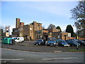
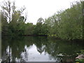
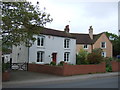
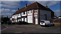
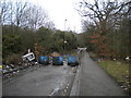
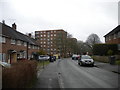
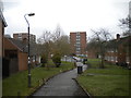
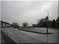
Photos of B28 0WE
Area Information
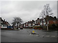
Living in B28 0WE means being part of a compact, suburban cluster in southeast Birmingham, historically rooted in Worcestershire. With a population of 1,711, this area blends residential calm with proximity to Birmingham’s urban energy. The Hall Green district, where B28 0WE lies, is noted for its low crime rates and historical significance, including landmarks like Sarehole Mill, which inspired J.R.R. Tolkien’s works. Daily life here balances suburban tranquillity with easy access to rail networks and retail hubs. The area’s character is defined by its older housing stock, family-oriented demographics, and a population density that reflects a mix of long-term residents and commuters. Its safety record and proximity to Birmingham’s core make it appealing for those seeking a secure, connected lifestyle without the city’s congestion. The postcode’s small size means a tight-knit community feel, with local amenities and transport links that cater to both practical needs and historical curiosity.
- Area Type
- Postcode
- Area Size
- Not available
- Population
- 1711
- Population Density
- 6736 people/km²
The property market in B28 0WE is characterised by high home ownership (80%) and a focus on houses rather than flats or apartments. This suggests a community where long-term residency and family living are common, with properties likely to be larger and more established. As a small postcode area, the housing stock is limited, which may mean competition for available homes. Buyers should consider that the market is not driven by rental demand but by owner-occupiers seeking stability. The prevalence of houses indicates a lack of high-density development, aligning with the area’s suburban feel. Prospective buyers may find opportunities in older properties with historical charm, though limited availability could mean longer search times. The area’s safety and transport links may also enhance its appeal for those prioritising security and connectivity over newer developments.
House Prices in B28 0WE
No properties found in this postcode.
Energy Efficiency in B28 0WE
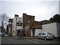
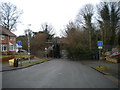
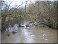
The lifestyle in B28 0WE is shaped by its mix of retail, transport, and historical sites. Nearby shops such as Co-op Haslucks, Tesco Robin, and Tesco Hall provide everyday convenience, while the rail and metro stations at Yardley Wood, Shirley, Hall Green, Grand Central New Street, and Corporation Street offer seamless access to Birmingham’s cultural and commercial centres. The area’s historical roots are evident in landmarks like Sarehole Mill, a watermill linked to J.R.R. Tolkien’s childhood, and the Church of the Ascension, a 1704 structure on School Road. Though the data does not mention parks, the area’s description as a “vibrant community blending commerce, history, and natural beauty” suggests opportunities for outdoor activities. The presence of the Hamlet, a group of 19th-century villas, adds architectural character, while the absence of major planning constraints allows for a flexible lifestyle focused on local amenities and connectivity.
Amenities
Schools
| Rank | School | Type | Entry gender | Ages |
|---|
Explore more schools in this area
Go to Schools tabDemographics
The population of B28 0WE has a median age of 47, with the majority of residents falling into the 30–64 age range. This suggests a community skewed toward adults, likely including families and professionals. Home ownership is high, at 80%, with houses being the predominant accommodation type. The predominant ethnic group is White, reflecting the broader demographic trends in the area. While no specific deprivation data is provided, the high home ownership rate and low crime score of 77/100 imply a stable, middle-income environment. The absence of protected natural areas or planning constraints may contribute to a lifestyle prioritising convenience over environmental restrictions. The age profile indicates a mature population, which could influence local services and amenities, such as schools and healthcare, to cater to older residents and families.
Household Size
Accommodation Type
Tenure
Ethnic Group
Religion
Household Composition
Age
Household Deprivation
NS-SEC
Explore more demographic insights in this area
Go to Demographics tabPlanning
Planning Constraints
- Flood RiskPremium
- Ramsar Wetland SitesPremium
- Area of Outstanding Natural BeautyPremium
- Protected Nature ReservePremium
- Protected WoodlandPremium
- Crime RiskPremium