Area Overview for B28 0SD
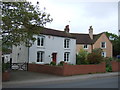
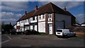
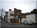
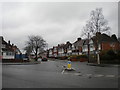
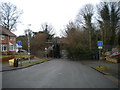
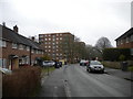
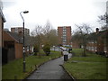
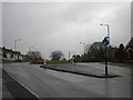
Photos of B28 0SD


Area Information
Living in B28 0SD, a small residential postcode cluster in Birmingham’s Selly Oak area, offers a blend of established community and proximity to the city’s core. The area spans parts of Billesley, Moseley, Hall Green, and Yardley Wood, with a population of 1,744 residents. Historically rooted, Billesley’s development began in 1921 with council estates built on former farmland, shaping a tight-knit neighbourhood. Today, it is bordered by green spaces like Billesley Common and Chinn Brook Meadows, offering residents access to open land. While the area’s population is small, it sits within a larger ward with 21,172 residents, suggesting a mix of local and broader Birmingham influences. The postcode’s compact nature means amenities and services are closely grouped, making daily life convenient. With a median age of 47, the community leans towards adults in their 30s to 60s, reflecting a settled demographic. For buyers, B28 0SD’s proximity to rail and metro stations, combined with low crime rates, makes it a practical choice for those seeking a balance between urban access and suburban calm.
- Area Type
- Postcode
- Area Size
- Not available
- Population
- 1744
- Population Density
- 4152 people/km²
The property market in B28 0SD is characterised by a 57% home ownership rate, with houses forming the primary accommodation type. This indicates a focus on owner-occupied properties, suggesting a community of settled residents rather than a transient rental market. The presence of houses, rather than flats or apartments, aligns with the area’s suburban nature and appeal to families. Given the postcode’s small size, the housing stock is likely limited in volume, making it a niche market for buyers seeking specific properties. The 57% ownership rate also implies that nearly half the properties are rented, potentially offering opportunities for investors. However, the compact nature of B28 0SD means buyers must consider the broader surrounding areas for more options. The mix of houses and rental properties reflects a balance between stability and flexibility, though the lack of high-rise or multi-unit developments suggests a quieter, more traditional residential environment.
House Prices in B28 0SD
No properties found in this postcode.
Energy Efficiency in B28 0SD
Residents of B28 0SD have access to a range of amenities within walking or short driving distance. Retail options include Asda Solihull New, Sainsburys Solihull Haslucks, and Heron Yardley, providing everyday shopping needs. For transport, the area is served by multiple rail stations, including Shirley and Yardley Wood, as well as metro stops like Grand Central New Street, facilitating easy travel to Birmingham’s business and cultural hubs. Green spaces such as Billesley Common, Chinn Brook Meadows, and Swanshurst Park offer recreational opportunities, while the nearby Dingles provide a sense of natural escape. The presence of these amenities fosters a convenient, community-oriented lifestyle, with a mix of practical services and open spaces. The area’s small size ensures that essentials are never far away, supporting a balanced daily life. Whether for shopping, commuting, or leisure, B28 0SD’s amenities cater to both routine needs and occasional outings, enhancing its appeal as a residential choice.
Amenities
Schools
| Rank | School | Type | Entry gender | Ages |
|---|
Explore more schools in this area
Go to Schools tabDemographics
The population of B28 0SD is 1,744, with a median age of 47 and the majority of residents aged 30–64. This suggests a community of middle-aged adults, likely with established careers and families. Home ownership rates stand at 57%, indicating a mix of owner-occupied and rented properties, though the area’s accommodation type is predominantly houses. This contrasts with the broader ward, which has a larger population, but B28 0SD’s smaller scale means its housing stock is more tightly focused. The predominant ethnic group is White, reflecting the broader demographic of Birmingham’s suburban areas. While no specific deprivation data is provided, the age profile and home ownership figures imply a stable, long-term resident base. The absence of significant diversity metrics means the community’s social fabric is likely homogenous, though this does not preclude pockets of variation. For buyers, the age range suggests a demand for family-friendly housing, with properties likely designed for long-term occupancy.
Household Size
Accommodation Type
Tenure
Ethnic Group
Religion
Household Composition
Age
Household Deprivation
NS-SEC
Explore more demographic insights in this area
Go to Demographics tabPlanning
Planning Constraints
- Flood RiskPremium
- Ramsar Wetland SitesPremium
- Area of Outstanding Natural BeautyPremium
- Protected Nature ReservePremium
- Protected WoodlandPremium
- Crime RiskPremium