Area Overview for B28 0RS
Photos of B28 0RS
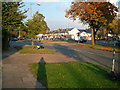

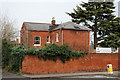
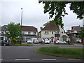
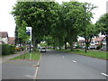
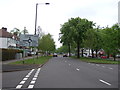
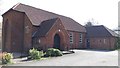
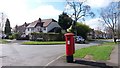
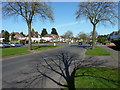
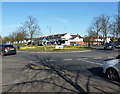
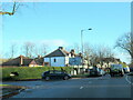
21 photos from this area
Area Information
Key information about the B28 0RS including its size, population, and administrative classification.
- Area Type
- Postcode
- Area Size
- 1.8 hectares
- Population
- 1817
- Population Density
- 4178 people/km²
House Prices in B28 0RS
23
Properties
£285,074
Average Sold Price
£63,000
Lowest Price
£575,000
Highest Price
Showing 23 properties
| Address | Type | Beds | Baths | Last Sale Price | Last Sale Date | |
|---|---|---|---|---|---|---|
| 51 Tixall Road, Birmingham, B28 0RS | Semi-detached | 3 | 1 | £235,000 | Dec 2023 | |
| 54 Tixall Road, Birmingham, B28 0RS | Bungalow | 5 | 3 | £460,000 | Sep 2023 | |
| 50 Tixall Road, Birmingham, B28 0RS | Semi-detached | 4 | 2 | £380,000 | Jun 2022 | |
| 63 Tixall Road, Birmingham, B28 0RS | Retail | 3 | 1 | £345,000 | May 2022 | |
| 56 Tixall Road, Birmingham, B28 0RS | Retail | 4 | 1 | £500,000 | Mar 2022 | |
| 52 Tixall Road, Birmingham, B28 0RS | house | - | - | £575,000 | Oct 2021 | |
| 65 Tixall Road, Birmingham, B28 0RS | house | - | - | £261,000 | Aug 2021 | |
| 75 Tixall Road, Birmingham, B28 0RS | Semi-detached | 5 | 2 | £450,000 | Jul 2021 | |
| 57 Tixall Road, Birmingham, B28 0RS | Semi-detached | 3 | - | £350,000 | Mar 2021 | |
| 47 Tixall Road, Birmingham, B28 0RS | Semi-detached | 3 | 1 | £237,500 | Apr 2015 |
Page 1 of 3
Energy Efficiency in B28 0RS
Amenities
Schools
| Rank | School | Type | Entry gender | Ages |
|---|
Explore more schools in this area
Go to Schools tabDemographics
Household Size
Family (3-5 people)
most common
Accommodation Type
Houses
most common
Tenure
90
majority
Ethnic Group
White
most common
Religion
N/A
most common
Household Composition
N/A
most common
Age
47
median
Adults (30-64 years)
most common
Household Deprivation
N/A
with no deprivation
NS-SEC
39
in Lower managerial occupations
Explore more demographic insights in this area
Go to Demographics tabPlanning
Planning Constraints
- Flood RiskPremium
- Ramsar Wetland SitesPremium
- Area of Outstanding Natural BeautyPremium
- Protected Nature ReservePremium
- Protected WoodlandPremium