Area Overview for B28 0PT
Photos of B28 0PT
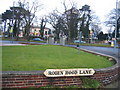
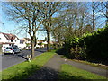
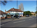
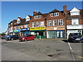

19 photos from this area
Area Information
Key information about the B28 0PT including its size, population, and administrative classification.
- Area Type
- Postcode
- Area Size
- 6944 m²
- Population
- 1584
- Population Density
- 5315 people/km²
House Prices in B28 0PT
14
Properties
£269,833
Average Sold Price
£126,000
Lowest Price
£525,000
Highest Price
Showing 14 properties
| Address | Type | Beds | Baths | Last Sale Price | Last Sale Date | |
|---|---|---|---|---|---|---|
| 9 Baldwins Lane, Birmingham, B28 0PT | house | - | - | £525,000 | Aug 2024 | |
| 11 Baldwins Lane, Birmingham, B28 0PT | house | - | - | £420,000 | Dec 2021 | |
| 37 Baldwins Lane, Birmingham, B28 0PT | house | - | - | £240,000 | Sep 2021 | |
| 27 Baldwins Lane, Birmingham, B28 0PT | Semi-detached | 5 | 2 | £258,500 | Sep 2016 | |
| 15 Baldwins Lane, Birmingham, B28 0PT | house | - | - | £273,000 | Apr 2014 | |
| 31 Baldwins Lane, Birmingham, B28 0PT | Detached | - | - | £280,000 | Nov 2013 | |
| 17 Baldwins Lane, Birmingham, B28 0PT | Semi-detached | 3 | 2 | £156,000 | Nov 2011 | |
| 29 Baldwins Lane, Birmingham, B28 0PT | Semi-detached | - | - | £150,000 | Mar 2002 | |
| 35 Baldwins Lane, Birmingham, B28 0PT | Terraced | - | - | £126,000 | Sep 1999 | |
| Flat 1, 25 Baldwins Lane, Birmingham, B28 0PT | Flat | - | - | - | - |
Page 1 of 2
Energy Efficiency in B28 0PT
Amenities
Schools
| Rank | School | Type | Entry gender | Ages |
|---|
Explore more schools in this area
Go to Schools tabDemographics
Household Size
Family (3-5 people)
most common
Accommodation Type
Houses
most common
Tenure
82
majority
Ethnic Group
asian_total
most common
Religion
N/A
most common
Household Composition
N/A
most common
Age
47
median
Adults (30-64 years)
most common
Household Deprivation
N/A
with no deprivation
NS-SEC
33
in Lower managerial occupations
Explore more demographic insights in this area
Go to Demographics tabPlanning
Planning Constraints
- Flood RiskPremium
- Ramsar Wetland SitesPremium
- Area of Outstanding Natural BeautyPremium
- Protected Nature ReservePremium
- Protected WoodlandPremium