Area Overview for B28 0NU
Photos of B28 0NU
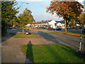

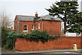
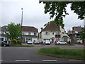
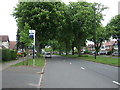
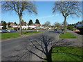
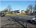
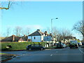
21 photos from this area
Area Information
Key information about the B28 0NU including its size, population, and administrative classification.
- Area Type
- Postcode
- Area Size
- 2.7 hectares
- Population
- 1790
- Population Density
- 6493 people/km²
House Prices in B28 0NU
63
Properties
£217,628
Average Sold Price
£69,500
Lowest Price
£475,000
Highest Price
Showing 63 properties
| Address | Type | Beds | Baths | Last Sale Price | Last Sale Date | |
|---|---|---|---|---|---|---|
| 55 Pipers Green, Birmingham, B28 0NU | Detached | 3 | 1 | £325,000 | Jan 2025 | |
| 26 Pipers Green, Birmingham, B28 0NU | Detached | 3 | 1 | £250,000 | Jun 2024 | |
| 56 Pipers Green, Birmingham, B28 0NU | Detached | 3 | 1 | £350,000 | May 2024 | |
| 88 Pipers Green, Birmingham, B28 0NU | Detached | 4 | 2 | £475,000 | Oct 2023 | |
| 41 Pipers Green, Birmingham, B28 0NU | Retail | 3 | 2 | £406,000 | Mar 2022 | |
| 79 Pipers Green, Birmingham, B28 0NU | Retail | 4 | 2 | £385,000 | Jan 2022 | |
| 28 Pipers Green, Birmingham, B28 0NU | Semi-detached | 3 | 1 | £305,000 | Aug 2020 | |
| 33 Pipers Green, Birmingham, B28 0NU | Semi-detached | 3 | 2 | £285,000 | Jun 2020 | |
| 20 Pipers Green, Birmingham, B28 0NU | Detached | 3 | 2 | £323,000 | Nov 2019 | |
| 42 Pipers Green, Birmingham, B28 0NU | Semi-detached | 3 | 1 | £250,000 | Jun 2019 |
Page 1 of 7
Energy Efficiency in B28 0NU
Amenities
Schools
| Rank | School | Type | Entry gender | Ages |
|---|
Explore more schools in this area
Go to Schools tabDemographics
Household Size
Family (3-5 people)
most common
Accommodation Type
Houses
most common
Tenure
85
majority
Ethnic Group
White
most common
Religion
N/A
most common
Household Composition
N/A
most common
Age
47
median
Adults (30-64 years)
most common
Household Deprivation
N/A
with no deprivation
NS-SEC
37
in Lower managerial occupations
Explore more demographic insights in this area
Go to Demographics tabPlanning
Planning Constraints
- Flood RiskPremium
- Ramsar Wetland SitesPremium
- Area of Outstanding Natural BeautyPremium
- Protected Nature ReservePremium
- Protected WoodlandPremium