Area Overview for B28 0NG
Photos of B28 0NG
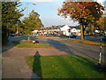

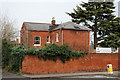
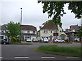
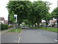
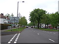
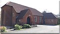
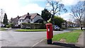
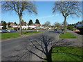
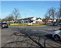
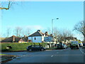
21 photos from this area
Area Information
Key information about the B28 0NG including its size, population, and administrative classification.
- Area Type
- Postcode
- Area Size
- 8048 m²
- Population
- 1790
- Population Density
- 6493 people/km²
House Prices in B28 0NG
21
Properties
£206,486
Average Sold Price
£66,500
Lowest Price
£355,000
Highest Price
Showing 21 properties
| Address | Type | Beds | Baths | Last Sale Price | Last Sale Date | |
|---|---|---|---|---|---|---|
| 30 Dalbury Road, Birmingham, B28 0NG | Semi-detached | 3 | 1 | £318,000 | Mar 2025 | |
| 12 Dalbury Road, Birmingham, B28 0NG | Semi-detached | 3 | 2 | £355,000 | Dec 2024 | |
| 16 Dalbury Road, Birmingham, B28 0NG | Terraced | - | - | £235,000 | Sep 2018 | |
| 40 Dalbury Road, Birmingham, B28 0NG | Semi-detached | 3 | 1 | £240,000 | Apr 2018 | |
| 24 Dalbury Road, Birmingham, B28 0NG | house | 3 | - | £187,000 | Nov 2014 | |
| 36 Dalbury Road, Birmingham, B28 0NG | Semi-detached | - | - | £158,000 | Aug 2012 | |
| 20 Dalbury Road, Birmingham, B28 0NG | Semi-detached | - | - | £180,000 | Apr 2012 | |
| 4 Dalbury Road, Birmingham, B28 0NG | house | 3 | - | £176,850 | Aug 2011 | |
| 2 Dalbury Road, Birmingham, B28 0NG | house | 3 | - | £182,000 | Aug 2010 | |
| 18 Dalbury Road, Birmingham, B28 0NG | Terraced | - | - | £173,000 | Feb 2004 |
Page 1 of 3
Energy Efficiency in B28 0NG
Amenities
Schools
| Rank | School | Type | Entry gender | Ages |
|---|
Explore more schools in this area
Go to Schools tabDemographics
Household Size
Family (3-5 people)
most common
Accommodation Type
Houses
most common
Tenure
85
majority
Ethnic Group
White
most common
Religion
N/A
most common
Household Composition
N/A
most common
Age
47
median
Adults (30-64 years)
most common
Household Deprivation
N/A
with no deprivation
NS-SEC
37
in Lower managerial occupations
Explore more demographic insights in this area
Go to Demographics tabPlanning
Planning Constraints
- Flood RiskPremium
- Ramsar Wetland SitesPremium
- Area of Outstanding Natural BeautyPremium
- Protected Nature ReservePremium
- Protected WoodlandPremium