Area Overview for B28 0JB
Photos of B28 0JB
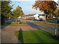

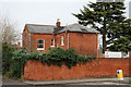
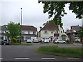
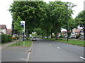
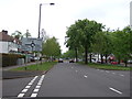
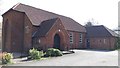
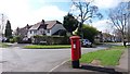
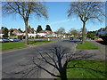
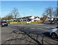
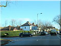
21 photos from this area
Area Information
Key information about the B28 0JB including its size, population, and administrative classification.
- Area Type
- Postcode
- Area Size
- 7367 m²
- Population
- 1771
- Population Density
- 6079 people/km²
House Prices in B28 0JB
18
Properties
£221,579
Average Sold Price
£68,000
Lowest Price
£375,000
Highest Price
Showing 18 properties
| Address | Type | Beds | Baths | Last Sale Price | Last Sale Date | |
|---|---|---|---|---|---|---|
| 31 Blackburne Road, Birmingham, B28 0JB | Detached | 3 | 1 | £257,500 | Sep 2025 | |
| 11 Blackburne Road, Birmingham, B28 0JB | Retail | 3 | 1 | £280,000 | Mar 2022 | |
| 35 Blackburne Road, Birmingham, B28 0JB | Detached | 3 | 1 | £375,000 | Jan 2022 | |
| 27 Blackburne Road, Birmingham, B28 0JB | house | - | - | £260,000 | Dec 2021 | |
| 37 Blackburne Road, Birmingham, B28 0JB | house | - | - | £331,500 | Dec 2017 | |
| 29 Blackburne Road, Birmingham, B28 0JB | house | - | - | £292,500 | Aug 2016 | |
| 15 Blackburne Road, Birmingham, B28 0JB | house | - | - | £212,000 | Feb 2016 | |
| 9 Blackburne Road, Birmingham, B28 0JB | house | - | - | £177,000 | Aug 2006 | |
| 33 Blackburne Road, Birmingham, B28 0JB | house | - | - | £220,000 | Nov 2004 | |
| 25 Blackburne Road, Birmingham, B28 0JB | Semi-detached | - | - | £95,500 | Nov 1999 |
Page 1 of 2
Energy Efficiency in B28 0JB
Amenities
Schools
| Rank | School | Type | Entry gender | Ages |
|---|
Explore more schools in this area
Go to Schools tabDemographics
Household Size
Family (3-5 people)
most common
Accommodation Type
Houses
most common
Tenure
83
majority
Ethnic Group
asian_total
most common
Religion
N/A
most common
Household Composition
N/A
most common
Age
47
median
Adults (30-64 years)
most common
Household Deprivation
N/A
with no deprivation
NS-SEC
34
in Lower managerial occupations
Explore more demographic insights in this area
Go to Demographics tabPlanning
Planning Constraints
- Flood RiskPremium
- Ramsar Wetland SitesPremium
- Area of Outstanding Natural BeautyPremium
- Protected Nature ReservePremium
- Protected WoodlandPremium