Area Overview for B27 7UL
Photos of B27 7UL
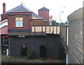
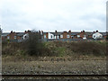
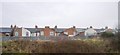
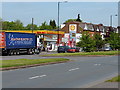
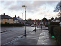
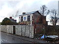
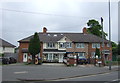
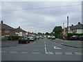
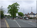
52 photos from this area
Area Information
Key information about the B27 7UL including its size, population, and administrative classification.
- Area Type
- Postcode
- Area Size
- 1.2 hectares
- Population
- 1863
- Population Density
- 5540 people/km²
House Prices in B27 7UL
24
Properties
£153,708
Average Sold Price
£60,000
Lowest Price
£275,000
Highest Price
Showing 24 properties
| Address | Type | Beds | Baths | Last Sale Price | Last Sale Date | |
|---|---|---|---|---|---|---|
| 120 Westley Road, Birmingham, B27 7UL | Semi-detached | 3 | 2 | £268,000 | Oct 2020 | |
| 132 Westley Road, Birmingham, B27 7UL | house | - | - | £275,000 | Sep 2020 | |
| 112 Westley Road, Birmingham, B27 7UL | Semi-detached | 3 | - | £187,500 | Apr 2015 | |
| 138 Westley Road, Birmingham, B27 7UL | Semi-detached | 3 | 1 | £100,000 | Mar 2015 | |
| 122 Westley Road, Birmingham, B27 7UL | Semi-detached | 4 | 3 | £202,000 | Oct 2014 | |
| 114 Westley Road, Birmingham, B27 7UL | house | 4 | - | £175,000 | Oct 2011 | |
| 140 Westley Road, Birmingham, B27 7UL | Semi-detached | - | - | £140,000 | Feb 2007 | |
| 104 Westley Road, Birmingham, B27 7UL | house | - | - | £158,000 | Oct 2005 | |
| 108 Westley Road, Birmingham, B27 7UL | Semi-detached | - | - | £75,000 | Sep 2005 | |
| 118 Westley Road, Birmingham, B27 7UL | Semi-detached | - | - | £120,000 | Oct 2002 |
Page 1 of 3
Energy Efficiency in B27 7UL
Amenities
Schools
| Rank | School | Type | Entry gender | Ages |
|---|
Explore more schools in this area
Go to Schools tabDemographics
Household Size
One person
most common
Accommodation Type
Houses
most common
Tenure
59
majority
Ethnic Group
White
most common
Religion
N/A
most common
Household Composition
N/A
most common
Age
47
median
Adults (30-64 years)
most common
Household Deprivation
N/A
with no deprivation
NS-SEC
22
in Lower managerial occupations
Explore more demographic insights in this area
Go to Demographics tabPlanning
Planning Constraints
- Flood RiskPremium
- Ramsar Wetland SitesPremium
- Area of Outstanding Natural BeautyPremium
- Protected Nature ReservePremium
- Protected WoodlandPremium