Area Overview for B27 7LD
Photos of B27 7LD
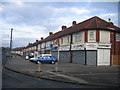
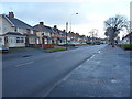
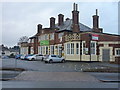
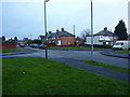
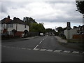
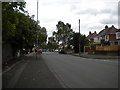
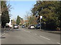
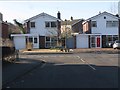
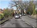
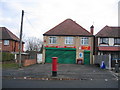
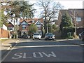
17 photos from this area
Area Information
Key information about the B27 7LD including its size, population, and administrative classification.
- Area Type
- Postcode
- Area Size
- 7955 m²
- Population
- 1607
- Population Density
- 8953 people/km²
House Prices in B27 7LD
31
Properties
£105,650
Average Sold Price
£28,500
Lowest Price
£210,000
Highest Price
Showing 31 properties
| Address | Type | Beds | Baths | Last Sale Price | Last Sale Date | |
|---|---|---|---|---|---|---|
| 34 Roydon Road, Birmingham, B27 7LD | Terraced | 2 | 1 | £152,500 | Sep 2023 | |
| 23 Roydon Road, Birmingham, B27 7LD | house | - | - | £148,000 | May 2023 | |
| 19 Roydon Road, Birmingham, B27 7LD | Retail | 3 | - | £210,000 | Dec 2022 | |
| 40 Roydon Road, Birmingham, B27 7LD | house | - | - | £85,000 | Jul 2013 | |
| 38 Roydon Road, Birmingham, B27 7LD | house | 3 | - | £100,000 | Mar 2013 | |
| 20 Roydon Road, Birmingham, B27 7LD | Semi-detached | 3 | 1 | £102,200 | Feb 2012 | |
| 30 Roydon Road, Birmingham, B27 7LD | Semi-detached | - | - | £126,000 | Jun 2007 | |
| 37 Roydon Road, Birmingham, B27 7LD | house | - | - | £87,950 | Feb 2004 | |
| 22 Roydon Road, Birmingham, B27 7LD | Terraced | 3 | 1 | £75,000 | Dec 2003 | |
| 16 Roydon Road, Birmingham, B27 7LD | Terraced | - | - | £47,000 | Aug 2000 |
Page 1 of 4
Energy Efficiency in B27 7LD
Amenities
Schools
| Rank | School | Type | Entry gender | Ages |
|---|
Explore more schools in this area
Go to Schools tabDemographics
Household Size
Family (3-5 people)
most common
Accommodation Type
Houses
most common
Tenure
50
majority
Ethnic Group
White
most common
Religion
N/A
most common
Household Composition
N/A
most common
Age
47
median
Adults (30-64 years)
most common
Household Deprivation
N/A
with no deprivation
NS-SEC
15
in Lower managerial occupations
Explore more demographic insights in this area
Go to Demographics tabPlanning
Planning Constraints
- Flood RiskPremium
- Ramsar Wetland SitesPremium
- Area of Outstanding Natural BeautyPremium
- Protected Nature ReservePremium
- Protected WoodlandPremium