Area Overview for B27 7JZ
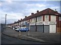
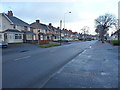
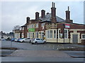
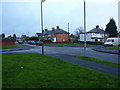
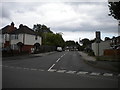
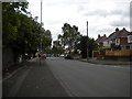
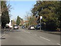
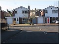
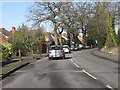
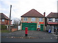
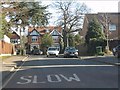
Photos of B27 7JZ

Area Information
Living in B27 7JZ, a small residential cluster in England’s West Midlands, offers a blend of suburban tranquillity and historical character. The area, part of Acocks Green, is defined by its rural origins and 17th-century roots, with Warwick Road serving as a key hub. With a population of 1,607, it is a compact community where homes are predominantly houses, reflecting a stable, family-oriented demographic. The median age of 47 suggests a mature population, with adults aged 30–64 forming the largest group. This area is accessible via nearby rail stations and close to Birmingham International Airport, making it practical for commuters. The presence of Severne Junior Infant and Nursery School, rated ‘good’ by Ofsted, highlights its appeal for families. While the postcode lacks major commercial centres, its proximity to retail outlets like Co-op Northfield and Tesco Solihull ensures everyday convenience. The low flood risk and absence of environmental constraints make it a pragmatic choice for buyers seeking a balance between heritage and modern amenities.
- Area Type
- Postcode
- Area Size
- Not available
- Population
- 1607
- Population Density
- 8953 people/km²
The property market in B27 7JZ is shaped by its 50% home ownership rate, indicating a balanced mix of owner-occupied and rental properties. Houses dominate the accommodation type, suggesting a focus on family homes and semi-detached or detached properties. This contrasts with areas dominated by flats or apartments, where rental demand often drives prices. The small postcode area’s limited size means the housing stock is concentrated, with fewer new developments likely to alter the market significantly. For buyers, this implies a stable but niche market, where properties are likely to be well-maintained and reflect the area’s historic character. The absence of major commercial or industrial zones nearby also reduces competition from speculative investment, making it a potentially undervalued option for those seeking traditional homes in a low-risk environment.
House Prices in B27 7JZ
No properties found in this postcode.
Energy Efficiency in B27 7JZ
The lifestyle in B27 7JZ is defined by accessible amenities and a suburban rhythm. Within practical reach are five retail outlets, including Co-op Northfield, Tesco Solihull, and Aldi Hall, ensuring everyday shopping needs are met. Rail stations like Olton and Hall Green provide easy access to Birmingham’s transport network, while proximity to Birmingham International Airport adds convenience for travel. The area’s historic character blends with modern facilities, offering a balance between quiet living and connectivity. Residents can enjoy a mix of local shops, transport options, and nearby green spaces, though specific parks or leisure facilities are not detailed in the data. This combination of practical amenities and low environmental risk supports a lifestyle that prioritises comfort and stability.
Amenities
Schools
The nearest school to B27 7JZ is Severne Junior Infant and Nursery School, a primary institution with a ‘good’ Ofsted rating. This school serves the area’s younger residents, providing a solid foundation for early education. The presence of a primary school with a strong rating is a key consideration for families, though the data does not mention secondary schools or other educational institutions. The single listed school suggests that parents may need to look beyond the immediate postcode for secondary education options. Nonetheless, the quality of the primary school contributes to the area’s appeal for households prioritising accessible, well-regarded schooling for their children.
| Rank | School | Type | Entry gender | Ages |
|---|
Explore more schools in this area
Go to Schools tabDemographics
The community in B27 7JZ is predominantly composed of adults aged 30–64, with a median age of 47. Home ownership stands at 50%, indicating a mix of owner-occupied and rental properties. The area is characterised by houses as the primary accommodation type, reflecting a settled, long-term resident base. The predominant ethnic group is White, though specific data on diversity or deprivation is not provided. This demographic profile suggests a mature, stable population with established ties to the area. The absence of detailed diversity statistics means the community’s full composition remains less defined, but the age range and home ownership rate point to a neighbourhood where families and professionals coexist. The area’s low environmental risk assessments and proximity to transport links further support its appeal to those prioritising safety and connectivity over urban vibrancy.
Household Size
Accommodation Type
Tenure
Ethnic Group
Religion
Household Composition
Age
Household Deprivation
NS-SEC
Explore more demographic insights in this area
Go to Demographics tabPlanning
Planning Constraints
- Flood RiskPremium
- Ramsar Wetland SitesPremium
- Area of Outstanding Natural BeautyPremium
- Protected Nature ReservePremium
- Protected WoodlandPremium