Area Overview for B27 7BT
Photos of B27 7BT
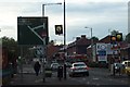
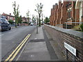
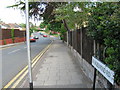

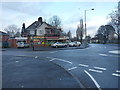
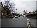
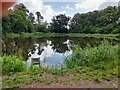
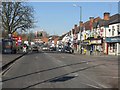
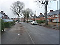
17 photos from this area
Area Information
Key information about the B27 7BT including its size, population, and administrative classification.
- Area Type
- Postcode
- Area Size
- 2.4 hectares
- Population
- 1757
- Population Density
- 7222 people/km²
House Prices in B27 7BT
62
Properties
£136,302
Average Sold Price
£86,950
Lowest Price
£195,000
Highest Price
Showing 62 properties
| Address | Type | Beds | Baths | Last Sale Price | Last Sale Date | |
|---|---|---|---|---|---|---|
| 118 Dolphin Lane, Birmingham, B27 7BT | Terraced | 2 | 1 | £195,000 | Mar 2025 | |
| 179 Dolphin Lane, Birmingham, B27 7BT | Terraced | 2 | 1 | £166,500 | Jan 2025 | |
| 130 Dolphin Lane, Birmingham, B27 7BT | Terraced | 2 | 1 | £170,000 | Jan 2023 | |
| 124 Dolphin Lane, Birmingham, B27 7BT | house | - | - | £141,000 | Jan 2022 | |
| 132 Dolphin Lane, Birmingham, B27 7BT | Terraced | 3 | 1 | £169,000 | Nov 2021 | |
| 187 Dolphin Lane, Birmingham, B27 7BT | house | - | - | £151,000 | Aug 2021 | |
| 177 Dolphin Lane, Birmingham, B27 7BT | Terraced | 3 | 1 | £151,000 | Feb 2021 | |
| 133 Dolphin Lane, Birmingham, B27 7BT | Terraced | 2 | 1 | £155,000 | Jun 2020 | |
| 161 Dolphin Lane, Birmingham, B27 7BT | Semi-detached | 3 | 1 | £155,000 | Feb 2020 | |
| 153 Dolphin Lane, Birmingham, B27 7BT | Terraced | 2 | 1 | £115,000 | Feb 2020 |
Page 1 of 7
Energy Efficiency in B27 7BT
Amenities
Schools
| Rank | School | Type | Entry gender | Ages |
|---|
Explore more schools in this area
Go to Schools tabDemographics
Household Size
Family (3-5 people)
most common
Accommodation Type
Houses
most common
Tenure
40
majority
Ethnic Group
White
most common
Religion
N/A
most common
Household Composition
N/A
most common
Age
22
median
Adults (30-64 years)
most common
Household Deprivation
N/A
with no deprivation
NS-SEC
19
in Lower managerial occupations
Explore more demographic insights in this area
Go to Demographics tabPlanning
Planning Constraints
- Flood RiskPremium
- Ramsar Wetland SitesPremium
- Area of Outstanding Natural BeautyPremium
- Protected Nature ReservePremium
- Protected WoodlandPremium