Area Overview for B27 6ST
Photos of B27 6ST
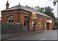


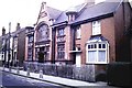

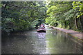
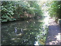
64 photos from this area
Area Information
Key information about the B27 6ST including its size, population, and administrative classification.
- Area Type
- Postcode
- Area Size
- 1.0 hectares
- Population
- 1895
- Population Density
- 6677 people/km²
House Prices in B27 6ST
38
Properties
£130,603
Average Sold Price
£45,000
Lowest Price
£245,000
Highest Price
Showing 38 properties
| Address | Type | Beds | Baths | Last Sale Price | Last Sale Date | |
|---|---|---|---|---|---|---|
| 59 Dagnall Road, Birmingham, B27 6ST | Semi-detached | 3 | 1 | £222,000 | Jan 2024 | |
| 41 Dagnall Road, Birmingham, B27 6ST | Terraced | 3 | 1 | £245,000 | Jul 2023 | |
| 61 Dagnall Road, Birmingham, B27 6ST | house | - | - | £195,000 | Mar 2021 | |
| 67 Dagnall Road, Birmingham, B27 6ST | Semi-detached | 2 | 1 | £151,000 | Apr 2017 | |
| 47 Dagnall Road, Birmingham, B27 6ST | Terraced | 3 | - | £144,950 | Feb 2017 | |
| 39 Dagnall Road, Birmingham, B27 6ST | Terraced | 3 | 1 | £145,000 | Feb 2016 | |
| 53 Dagnall Road, Birmingham, B27 6ST | house | 3 | - | £129,950 | May 2012 | |
| 57 Dagnall Road, Birmingham, B27 6ST | Terraced | - | - | £138,000 | Dec 2009 | |
| 63 Dagnall Road, Birmingham, B27 6ST | house | - | - | £122,000 | Feb 2009 | |
| 27 Dagnall Road, Birmingham, B27 6ST | house | 3 | - | £131,000 | Jan 2008 |
Page 1 of 4
Energy Efficiency in B27 6ST
Amenities
Schools
| Rank | School | Type | Entry gender | Ages |
|---|
Explore more schools in this area
Go to Schools tabDemographics
Household Size
Family (3-5 people)
most common
Accommodation Type
Houses
most common
Tenure
65
majority
Ethnic Group
White
most common
Religion
N/A
most common
Household Composition
N/A
most common
Age
47
median
Adults (30-64 years)
most common
Household Deprivation
N/A
with no deprivation
NS-SEC
29
in Lower managerial occupations
Explore more demographic insights in this area
Go to Demographics tabPlanning
Planning Constraints
- Flood RiskPremium
- Ramsar Wetland SitesPremium
- Area of Outstanding Natural BeautyPremium
- Protected Nature ReservePremium
- Protected WoodlandPremium