Area Overview for B27 6SG
Photos of B27 6SG


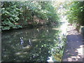
64 photos from this area
Area Information
Key information about the B27 6SG including its size, population, and administrative classification.
- Area Type
- Postcode
- Area Size
- 1.3 hectares
- Population
- 1706
- Population Density
- 5961 people/km²
House Prices in B27 6SG
35
Properties
£201,481
Average Sold Price
£72,000
Lowest Price
£363,000
Highest Price
Showing 35 properties
| Address | Type | Beds | Baths | Last Sale Price | Last Sale Date | |
|---|---|---|---|---|---|---|
| 73 Cambridge Way, Birmingham, B27 6SG | Detached | 3 | 2 | £357,000 | Dec 2024 | |
| 63 Cambridge Way, Birmingham, B27 6SG | Detached | 4 | 2 | £363,000 | May 2024 | |
| 19 Cambridge Way, Birmingham, B27 6SG | Semi-detached | 2 | 1 | £238,000 | Jan 2024 | |
| 77 Cambridge Way, Birmingham, B27 6SG | Semi-detached | 3 | 1 | £274,000 | Jun 2023 | |
| 35 Cambridge Way, Birmingham, B27 6SG | Semi-detached | 3 | 1 | £245,000 | Sep 2022 | |
| 21 Cambridge Way, Birmingham, B27 6SG | Semi-detached | 2 | 1 | £204,000 | Apr 2022 | |
| 53 Cambridge Way, Birmingham, B27 6SG | house | - | - | £335,000 | May 2021 | |
| 51 Cambridge Way, Birmingham, B27 6SG | Detached | 3 | 1 | £206,000 | Feb 2020 | |
| 75 Cambridge Way, Birmingham, B27 6SG | Semi-detached | 3 | 1 | £245,000 | Sep 2018 | |
| 3 Cambridge Way, Birmingham, B27 6SG | Detached | 4 | 2 | £292,500 | Sep 2016 |
Page 1 of 4
Energy Efficiency in B27 6SG
Amenities
Schools
| Rank | School | Type | Entry gender | Ages |
|---|
Explore more schools in this area
Go to Schools tabDemographics
Household Size
One person
most common
Accommodation Type
Houses
most common
Tenure
58
majority
Ethnic Group
White
most common
Religion
N/A
most common
Household Composition
N/A
most common
Age
47
median
Adults (30-64 years)
most common
Household Deprivation
N/A
with no deprivation
NS-SEC
31
in Lower managerial occupations
Explore more demographic insights in this area
Go to Demographics tabPlanning
Planning Constraints
- Flood RiskPremium
- Ramsar Wetland SitesPremium
- Area of Outstanding Natural BeautyPremium
- Protected Nature ReservePremium
- Protected WoodlandPremium