Area Overview for B27 6DP
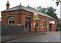
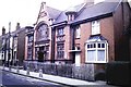
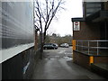
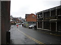
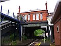
Photos of B27 6DP


Area Information
B27 6DP, known locally as Acocks Green, is a suburban area in southeast Birmingham with a population of 1,597. This small postcode area reflects a historic residential cluster that evolved from medieval hamlets along the Warwick Road. Its character is defined by a mix of listed buildings, tree-lined streets, and a long-standing community feel. The area’s proximity to major transport routes, including the Birmingham to Oxford Railway and nearby rail stations, has shaped its development over centuries. Today, it balances suburban convenience with a touch of rural heritage. Residents benefit from a compact layout where amenities are within practical reach, and the area’s low flood risk ensures a stable living environment. While the population is modest, the community is tightly knit, with a median age of 47 and a focus on family-oriented living. For those considering homes in B27 6DP, the blend of historical charm and modern connectivity offers a distinct lifestyle in the heart of Birmingham.
- Area Type
- Postcode
- Area Size
- Not available
- Population
- 1597
- Population Density
- 6015 people/km²
The property market in B27 6DP is characterised by a 33% home ownership rate, indicating that a significant portion of the housing stock is rented. Flats dominate the accommodation type, which is typical for suburban areas with limited space for larger homes. This suggests a market skewed towards rental properties, potentially offering affordability for buyers seeking investment opportunities. The low home ownership rate may also reflect the area’s history as a residential suburb with a focus on community over individual property ownership. For prospective buyers, the limited number of owner-occupied homes could mean competition for available properties, particularly in the flat market. The compact nature of the postcode area means that properties are likely to be in close proximity to amenities and transport links, which could be a draw for those prioritising convenience. However, the relatively small population and housing stock may limit the range of options for buyers.
House Prices in B27 6DP
No properties found in this postcode.
Energy Efficiency in B27 6DP
Living in B27 6DP offers access to a range of amenities within practical reach. Retail options include Iceland Acocks, Morrisons Acocks, and Farmfoods Acocks, providing grocery and household essentials. The area’s rail network connects residents to key destinations, with stations like Acocks Green Railway Station offering links to Birmingham’s central areas and beyond. Nearby, Birmingham International Airport is within reach, facilitating travel for both leisure and business. The presence of multiple rail and metro connections ensures that commuting is convenient, while the retail options cater to daily needs. The area’s historic character blends with modern convenience, offering a lifestyle that balances suburban tranquillity with urban accessibility. Residents can enjoy a mix of local shopping, transport efficiency, and proximity to larger city amenities without the need for long commutes.
Amenities
Schools
The nearest school to B27 6DP is Holy Souls Catholic Primary School, which serves the area with a primary education offering. The school has an Ofsted rating of ‘good,’ indicating a satisfactory standard of teaching and facilities. As a primary school, it caters to younger children, and its location within the postcode area ensures easy access for local families. The absence of secondary schools in the immediate vicinity means that students may need to travel to nearby areas for higher education, though the quality of the primary school suggests a strong foundation for learning. The single school listed in the data highlights the need for families to consider proximity to secondary education when choosing to live in B27 6DP. The ‘good’ rating provides reassurance about the school’s performance, though further research would be necessary to assess its full range of offerings.
| Rank | School | Type | Entry gender | Ages |
|---|
Explore more schools in this area
Go to Schools tabDemographics
The population of B27 6DP is 1,597, with a median age of 47. The majority of residents fall within the 30–64 age range, reflecting a community centred on adults. Home ownership here is relatively low at 33%, suggesting a higher proportion of rental properties. The accommodation type is predominantly flats, which aligns with the area’s suburban density. The predominant ethnic group is White, though specific diversity statistics are not provided. This demographic profile indicates a mature, stable population with established households. The lower home ownership rate may influence the local property market, making it more accessible for renters. However, the presence of a 33% owner-occupied rate also suggests opportunities for buyers seeking long-term investment. The age distribution and housing stock reflect a community that prioritises convenience over large-scale development, with a focus on maintaining the area’s historic character.
Household Size
Accommodation Type
Tenure
Ethnic Group
Religion
Household Composition
Age
Household Deprivation
NS-SEC
Explore more demographic insights in this area
Go to Demographics tabPlanning
Planning Constraints
- Flood RiskPremium
- Ramsar Wetland SitesPremium
- Area of Outstanding Natural BeautyPremium
- Protected Nature ReservePremium
- Protected WoodlandPremium