Area Overview for B27 6BD
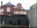
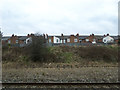
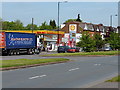
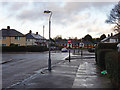
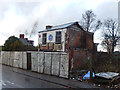
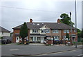
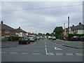
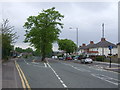
Photos of B27 6BD


Area Information
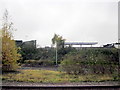
Living in B27 6BD, part of Tyseley and Hay Mills in Birmingham, means being part of a small residential cluster with a population of 1,789. Situated east of the city, it borders Small Heath and South Yardley, with the A45 Coventry Road as its central spine. Historically a Worcestershire parish, the area became part of Birmingham in 1911. Its industrial roots are evident in landmarks like Hay Hall, a 15th-century Grade II listed hall, and the Tyseley Energy Park, now a hub for green innovation. Daily life here blends historical architecture with modern developments, including the Tyseley Environmental Enterprise District. The area’s compact size means amenities are within walking or cycling distance, while its proximity to major roads and rail links offers connectivity to Birmingham’s broader network. Residents benefit from a mix of heritage and contemporary infrastructure, making it a distinctive choice for those seeking a balance between tradition and progress.
- Area Type
- Postcode
- Area Size
- Not available
- Population
- 1789
- Population Density
- 2149 people/km²
The property market in B27 6BD is characterised by a 50% home ownership rate, with houses forming the predominant accommodation type. This suggests a focus on single-family homes rather than flats or apartments, aligning with the area’s residential cluster identity. Given the small population and compact size, the housing stock is likely limited, with properties concentrated around key roads like the A45 Coventry Road. The 50% home ownership rate indicates a mix of owner-occupied and rental properties, though the exact proportion of the rental market is unspecified. For buyers, this means competition for available homes could be high, particularly for properties in well-located areas near transport links or amenities. The presence of historical sites like Hay Hall and modern developments such as Tyseley Energy Park may influence property values, with buyers needing to weigh proximity to these features against practical considerations like commute times and local infrastructure.
House Prices in B27 6BD
No properties found in this postcode.
Energy Efficiency in B27 6BD
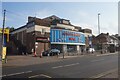
Life in B27 6BD offers a blend of practical amenities and historical charm. Within reach are retail options like Asda Merestones, Iceland Acocks, and Lidl Acocks, providing everyday shopping convenience. The area’s transport links, including five railway stations and metro stops, ensure easy access to Birmingham’s commercial and cultural hubs. Nearby, the Grade II listed Hay Hall offers a glimpse into the region’s medieval past, while the Tyseley Energy Park represents modern innovation in green technology. The Tyseley Traction Maintenance Depot, now home to Vintage Trains, adds a unique industrial heritage element. Though the area’s small size means limited green spaces, its proximity to the River Cole and surrounding roads suggests opportunities for walking or cycling. The mix of historical sites, retail, and transport infrastructure creates a lifestyle that balances practicality with a touch of local history.
Amenities
Schools
| Rank | School | Type | Entry gender | Ages |
|---|
Explore more schools in this area
Go to Schools tabDemographics
The community in B27 6BD has a median age of 47, with the most common age range being adults aged 30–64. This suggests a mature, settled population, likely with established careers and families. Home ownership stands at 50%, indicating a balanced mix of owner-occupied and rental properties. The predominant accommodation type is houses, reflecting a residential character that prioritises private living spaces over flats. The predominant ethnic group is White, though specific diversity statistics are not provided. The age profile and home ownership rate suggest a stable, long-term community with limited turnover. However, the 50% home ownership rate also implies a significant proportion of residents may rent, potentially influencing local housing dynamics. The absence of detailed diversity data means broader demographic trends remain unquantified, but the area’s historical ties to manufacturing and industry suggest a workforce-oriented demographic.
Household Size
Accommodation Type
Tenure
Ethnic Group
Religion
Household Composition
Age
Household Deprivation
NS-SEC
Explore more demographic insights in this area
Go to Demographics tabPlanning
Planning Constraints
- Flood RiskPremium
- Ramsar Wetland SitesPremium
- Area of Outstanding Natural BeautyPremium
- Protected Nature ReservePremium
- Protected WoodlandPremium