Area Overview for B27 6AN
Photos of B27 6AN


Area Information
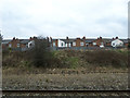
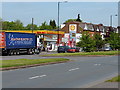
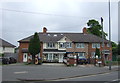
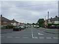
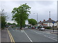
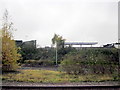
Living in B27 6AN means inhabiting a small, defined postcode area in Birmingham’s east, adjacent to Small Heath and South Yardley. With a population of 1,789, this cluster of homes is shaped by its historical roots as part of Worcestershire before its 1911 incorporation into Birmingham. The area is bisected by the A45 (Coventry Road), a key artery linking Birmingham to Coventry, and bordered by the Grand Union Canal to the south. Daily life here is influenced by its industrial legacy, including the former Webster Horsfall wire-drawing mill and the modern Tyseley Energy Park, which anchors the Tyseley Environmental Enterprise District. Residents benefit from proximity to rail and metro networks, with Tyseley Railway Station and Acocks Green Railway Station offering connections to central Birmingham and beyond. The area’s character blends historical architecture, like the 15th-century Hay Hall, with contemporary innovation, making it a niche spot for those seeking a mix of heritage and practicality.
- Area Type
- Postcode
- Area Size
- Not available
- Population
- 1789
- Population Density
- 2149 people/km²
B27 6AN is a small area with a clear housing profile: 50% of properties are owner-occupied, and the majority are houses rather than flats or apartments. This suggests a market skewed toward family homes and long-term residents, with limited rental availability. The compact size of the postcode means the housing stock is concentrated, and buyers should consider the immediate surroundings for broader options. The predominance of houses implies a focus on space and privacy, which may appeal to those seeking suburban living. However, the lack of data on property prices or recent developments means buyers must investigate local listings and compare with nearby areas like Small Heath or Yardley. The mix of owner-occupied and rented properties also hints at a balanced but modest market, with potential for growth in green energy initiatives like Tyseley Energy Park.
House Prices in B27 6AN
No properties found in this postcode.
Energy Efficiency in B27 6AN
Residents of B27 6AN have access to essential amenities within walking or short driving distance. Retail options include Asda Merestones, Iceland Acocks, and Lidl Acocks, catering to everyday needs. The area’s proximity to Tyseley Railway Station and multiple metro stops enhances connectivity to Birmingham’s cultural and commercial hubs. Historically, the district’s industrial legacy is preserved in sites like Hay Hall, a Grade II listed 15th-century building, and Tyseley Energy Park, which drives innovation in green energy. While parks and leisure facilities are not explicitly detailed in the data, the area’s mix of historic and modern infrastructure suggests a balance of practicality and character. The presence of rail and retail amenities, combined with the area’s strategic location, makes daily life convenient for both commuters and those prioritising accessibility.
Amenities
Schools
| Rank | School | Type | Entry gender | Ages |
|---|
Explore more schools in this area
Go to Schools tabDemographics
The population of B27 6AN skews toward adults aged 30–64, with a median age of 47. This suggests a community of established professionals and families, many of whom own their homes—50% of properties are owner-occupied, compared to 50% rented. The accommodation type is predominantly houses, reflecting a suburban or semi-rural layout rather than high-density housing. The predominant ethnic group is White, with no data provided on other demographics. The age profile indicates a mature population, which may influence local services and amenities. However, the absence of specific data on deprivation or socioeconomic diversity means this snapshot remains limited. The 50% home ownership rate suggests a stable market but also potential challenges for renters seeking long-term housing.
Household Size
Accommodation Type
Tenure
Ethnic Group
Religion
Household Composition
Age
Household Deprivation
NS-SEC
Explore more demographic insights in this area
Go to Demographics tabPlanning
Planning Constraints
- Flood RiskPremium
- Ramsar Wetland SitesPremium
- Area of Outstanding Natural BeautyPremium
- Protected Nature ReservePremium
- Protected WoodlandPremium