Area Overview for B27 6AD
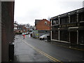
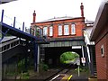
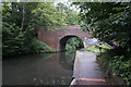
Photos of B27 6AD


Area Information
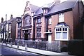
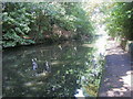
Living in B27 6AD means residing in a small, tightly knit residential cluster in southeast Birmingham, England. With a population of 1,597, the area retains a historic suburban character shaped by rural origins and 19th-century infrastructure. Situated near the Warwick Road roundabout, it evolved from medieval hamlets into a residential suburb with listed buildings and a long-standing community. The area’s compact size and proximity to transport links make it convenient for daily life, while its mix of historic and modern features reflects a balance between tradition and practicality. Residents benefit from nearby rail stations, retail hubs, and a primary school with a good Ofsted rating. Though small, the area offers a distinct identity, blending suburban tranquility with the vibrancy of a growing city suburb. For those seeking a place with a sense of history and accessible amenities, B27 6AD provides a compact yet functional living environment.
- Area Type
- Postcode
- Area Size
- Not available
- Population
- 1597
- Population Density
- 6015 people/km²
The property market in B27 6AD is characterised by a low home ownership rate of 33%, suggesting that the area is more rental-oriented than owner-occupied. The predominant accommodation type is flats, which aligns with the needs of smaller households or individuals seeking manageable living spaces. This housing stock may appeal to tenants looking for convenience and affordability, though buyers should consider the limited number of owner-occupied properties. The small size of the area means that property choices are concentrated, and potential buyers may need to look beyond immediate surroundings for more options. Historic buildings and redeveloped sites, such as the former Stockfield Estate, add to the area’s character but may also influence property availability. The mix of flats and older homes reflects a balance between modern practicality and traditional architecture.
House Prices in B27 6AD
Showing 1 properties
| Address | Type | Beds | Baths | Last Sale Price | Last Sale Date | |
|---|---|---|---|---|---|---|
| Olivet, 17 Sherbourne Road, Acocks Green Olton, Birmingham, B27 6AD | Flat | - | - | - | - |
Energy Efficiency in B27 6AD
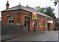
Residents of B27 6AD have access to a range of amenities within practical reach. The area includes retail outlets such as Iceland Acocks, Morrisons Acocks, and Farmfoods Acocks, providing essential shopping options. Nearby rail stations like Acocks Green and Spring Road offer convenient transport links, while metro stops such as Corporation Street and Grand Central New Street enhance connectivity to Birmingham’s central areas. The historic character of the area is complemented by its practicality, with listed buildings and a sense of community coexisting with modern facilities. The presence of a primary school with a good Ofsted rating adds to the appeal for families, and the area’s small size ensures that amenities are easily accessible. This blend of convenience and heritage contributes to a lifestyle that balances suburban tranquility with urban accessibility.
Amenities
Schools
The nearest school to B27 6AD is Holy Souls Catholic Primary School, a primary school with a good Ofsted rating. This institution serves the local community and provides education for younger residents. The presence of a single primary school suggests that families in the area may rely on it for early education, though secondary school options would require commuting to nearby areas. The good Ofsted rating indicates a satisfactory standard of teaching and facilities, which is a positive factor for families prioritising quality education. Given the area’s small size, the school likely plays a central role in the local community, offering both educational and social opportunities for residents.
| Rank | School | Type | Entry gender | Ages |
|---|
Explore more schools in this area
Go to Schools tabDemographics
The community in B27 6AD is predominantly middle-aged, with a median age of 47 and the most common age range being adults aged 30–64. Home ownership is relatively low at 33%, suggesting a higher proportion of renters in the area. The primary accommodation type is flats, reflecting a housing stock suited to smaller households or families seeking manageable living spaces. The predominant ethnic group is White, though specific diversity statistics are not provided. The age profile indicates a mature population, which may influence local services and amenities. With a population of 1,597, the area is small enough to foster a close-knit community but large enough to support essential services. The lower home ownership rate could indicate a reliance on rental properties, potentially affecting property values and investment opportunities.
Household Size
Accommodation Type
Tenure
Ethnic Group
Religion
Household Composition
Age
Household Deprivation
NS-SEC
Explore more demographic insights in this area
Go to Demographics tabPlanning
Planning Constraints
- Flood RiskPremium
- Ramsar Wetland SitesPremium
- Area of Outstanding Natural BeautyPremium
- Protected Nature ReservePremium
- Protected WoodlandPremium