Area Overview for B26 3NG
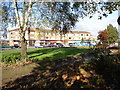
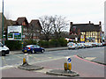
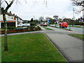
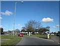
Photos of B26 3NG


Area Information
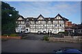
B26 3NG is a small residential cluster in east Birmingham, nestled near the Solihull border. With a population of 1,628, it reflects a quiet suburban character, blending historical roots with modern living. Sheldon, the area’s ward, traces its name to the Domesday Book, where it was recorded as “Machitone.” The parish church, St Giles, stands as a 14th-century sandstone structure with medieval arches and 19th-century stained glass, offering a tangible link to the past. Despite its historic ties, the area is practical for contemporary life, with easy access to Birmingham International Airport and nearby rail stations. Residents benefit from proximity to both urban and semi-rural settings, making it a strategic choice for those seeking a balance between city amenities and suburban calm. The postcode’s compact size means it feels close-knit, yet it is well-connected to broader networks of transport and retail, ensuring daily needs are met without the congestion of central Birmingham.
- Area Type
- Postcode
- Area Size
- Not available
- Population
- 1628
- Population Density
- 2602 people/km²
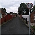
The property market in B26 3NG is dominated by owner-occupied homes, with 76% of properties owned outright. This contrasts with rental markets typical of more transient areas, suggesting a community of settled residents. The accommodation type is predominantly houses, which is uncommon in denser urban areas but aligns with the suburban nature of Sheldon. This housing stock likely includes traditional semi-detached or detached homes, reflecting the area’s historical development. For buyers, this means a focus on established properties rather than new builds, though the small size of the postcode may limit options. The low flood risk and absence of environmental constraints (such as protected woodlands or AONBs) further enhance the appeal for those seeking secure, long-term investments. However, the limited scale of the area means buyers may need to look beyond B26 3NG for larger property selections.
House Prices in B26 3NG
No properties found in this postcode.
Energy Efficiency in B26 3NG
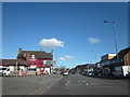
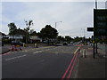
Living in B26 3NG offers a mix of practical retail and transport options. Nearby shops include M&S Sheldon, Morrisons Sheldon, and Iceland Sheldon, providing essentials within walking distance. The area’s rail network is extensive, with five stations offering links to Birmingham’s city centre and surrounding towns. Birmingham International Airport is a short journey away, making travel abroad convenient. While the area lacks large leisure facilities, its proximity to rail and metro hubs ensures access to cultural and recreational opportunities in Birmingham. The presence of multiple retail outlets and transport links contributes to a lifestyle that prioritises convenience over luxury, catering to those who value accessibility over sprawling amenities.
Amenities
Schools
| Rank | School | Type | Entry gender | Ages |
|---|
Explore more schools in this area
Go to Schools tabDemographics
The community in B26 3NG is predominantly composed of adults aged 30–64, with a median age of 47. This suggests a stable, mature population, likely focused on family life or established careers. Home ownership is high at 76%, indicating a strong presence of long-term residents who have invested in their properties. The accommodation type is primarily houses, which aligns with the area’s suburban character and may appeal to those seeking more space than apartments. The predominant ethnic group is White, reflecting broader trends in the West Midlands. While no specific deprivation data is provided, the high home ownership rate and age profile suggest a community with relatively stable economic conditions. However, the lack of detailed diversity metrics means the full demographic picture remains partially obscured.
Household Size
Accommodation Type
Tenure
Ethnic Group
Religion
Household Composition
Age
Household Deprivation
NS-SEC
Explore more demographic insights in this area
Go to Demographics tabPlanning
Planning Constraints
- Flood RiskPremium
- Ramsar Wetland SitesPremium
- Area of Outstanding Natural BeautyPremium
- Protected Nature ReservePremium
- Protected WoodlandPremium