Area Overview for B26 3LF
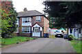
Photos of B26 3LF


Area Information
Living in B26 3LF means being part of a small, defined residential cluster in east Birmingham, near the Solihull border. With a population of 1,628, this area blends historical roots with modern convenience. Sheldon, the ward it belongs to, has ancient origins dating back to the Domesday Book, yet today it offers practical amenities like M&S Sheldon, Morrisons Sheldon, and Iceland Sheldon for daily needs. The area’s proximity to railway stations such as Olton and Acocks Green ensures easy access to Birmingham’s transport network. While the community is compact, it sits within a suburban setting, balancing urban connectivity with a quieter residential feel. The median age of 47 suggests a mature demographic, with many residents likely established in their careers and families. This postcode is ideal for those seeking a stable, low-flood-risk environment, though crime rates demand attention. Its mix of historical landmarks, like St Giles Church, and modern infrastructure makes it a distinctive choice for homebuyers prioritising safety and accessibility.
- Area Type
- Postcode
- Area Size
- Not available
- Population
- 1628
- Population Density
- 2602 people/km²
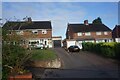
The property market in B26 3LF is characterised by high home ownership (76%) and a predominance of houses over flats or apartments. This suggests a community of long-term residents, many of whom may have purchased properties in the area for stability. The limited size of the postcode area means the housing stock is concentrated, with fewer options for buyers compared to larger urban zones. However, the proximity to Birmingham’s transport hubs, including rail stations and the international airport, may make it appealing for commuters. Given the low flood risk and the presence of nearby amenities, properties here are likely to retain value. Buyers should note the small scale of the area, which may limit availability, and consider whether the focus on owner-occupied homes aligns with their investment goals.
House Prices in B26 3LF
No properties found in this postcode.
Energy Efficiency in B26 3LF
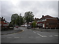
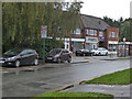
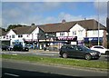
Daily life in B26 3LF is supported by a range of nearby amenities, including retail options like M&S Sheldon, Morrisons Sheldon, and Iceland Sheldon, which cater to household needs. The proximity to rail stations such as Olton and Acocks Green, along with metro connections like Birmingham International Airport, ensures easy access to leisure, work, and travel. While the area lacks large parks or cultural hubs, its suburban setting offers a quieter alternative to central Birmingham. The presence of St Giles Church, a 14th-century landmark, adds historical interest. Residents can combine practical shopping with efficient transport, though the small size of the area means amenities are concentrated. This balance of convenience and accessibility makes B26 3LF suitable for those prioritising ease of movement and local services.
Amenities
Schools
| Rank | School | Type | Entry gender | Ages |
|---|
Explore more schools in this area
Go to Schools tabDemographics
The community in B26 3LF is predominantly composed of adults aged 30–64, reflecting a median age of 47. This suggests a settled population, likely with strong ties to local institutions and employment. Home ownership is high, with 76% of properties occupied by their owners, indicating a stable housing market. The area’s accommodation is largely houses, rather than flats or apartments, which aligns with the suburban character of the ward. The predominant ethnic group is White, though no specific diversity statistics are provided. The population size of 1,628 means the area is small but cohesive, with a focus on family-oriented living. The absence of significant deprivation data implies a generally stable quality of life, though the high crime risk score of 1/100 suggests residents may need to consider security measures.
Household Size
Accommodation Type
Tenure
Ethnic Group
Religion
Household Composition
Age
Household Deprivation
NS-SEC
Explore more demographic insights in this area
Go to Demographics tabPlanning
Planning Constraints
- Flood RiskPremium
- Ramsar Wetland SitesPremium
- Area of Outstanding Natural BeautyPremium
- Protected Nature ReservePremium
- Protected WoodlandPremium