Area Overview for B26 2DB
Photos of B26 2DB
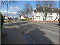
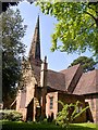
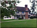
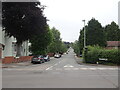
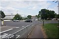
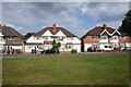
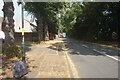
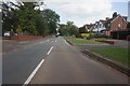
53 photos from this area
Area Information
Key information about the B26 2DB including its size, population, and administrative classification.
- Area Type
- Postcode
- Area Size
- 1.3 hectares
- Population
- 1437
- Population Density
- 6624 people/km²
House Prices in B26 2DB
53
Properties
£128,470
Average Sold Price
£43,500
Lowest Price
£240,000
Highest Price
Showing 53 properties
| Address | Type | Beds | Baths | Last Sale Price | Last Sale Date | |
|---|---|---|---|---|---|---|
| 51 Amanda Drive, Birmingham, B26 2DB | Flat | 2 | 1 | £80,000 | Dec 2025 | |
| 35 Amanda Drive, Birmingham, B26 2DB | Terraced | 2 | 1 | £154,500 | Apr 2025 | |
| 57 Amanda Drive, Birmingham, B26 2DB | Semi-detached | 3 | 1 | £205,000 | Mar 2025 | |
| 45 Amanda Drive, Birmingham, B26 2DB | house | - | - | £225,000 | Dec 2024 | |
| 66 Amanda Drive, Birmingham, B26 2DB | Terraced | 2 | 1 | £205,000 | Mar 2023 | |
| 64 Amanda Drive, Birmingham, B26 2DB | Terraced | 3 | 1 | £233,500 | Mar 2023 | |
| 40 Amanda Drive, Birmingham, B26 2DB | Terraced | 3 | 1 | £170,000 | Feb 2023 | |
| 24 Amanda Drive, Birmingham, B26 2DB | Terraced | 2 | 1 | £189,999 | Feb 2023 | |
| 60 Amanda Drive, Birmingham, B26 2DB | Flat | 2 | 1 | £136,000 | Feb 2023 | |
| 42 Amanda Drive, Birmingham, B26 2DB | Retail | 3 | 1 | £240,000 | Sep 2022 |
Page 1 of 6
Energy Efficiency in B26 2DB
Amenities
Schools
| Rank | School | Type | Entry gender | Ages |
|---|
Explore more schools in this area
Go to Schools tabDemographics
Household Size
Family (3-5 people)
most common
Accommodation Type
Houses
most common
Tenure
63
majority
Ethnic Group
White
most common
Religion
N/A
most common
Household Composition
N/A
most common
Age
47
median
Adults (30-64 years)
most common
Household Deprivation
N/A
with no deprivation
NS-SEC
22
in Lower managerial occupations
Explore more demographic insights in this area
Go to Demographics tabPlanning
Planning Constraints
- Flood RiskPremium
- Ramsar Wetland SitesPremium
- Area of Outstanding Natural BeautyPremium
- Protected Nature ReservePremium
- Protected WoodlandPremium