Area Overview for B26 1PE
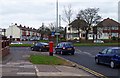
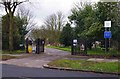
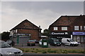
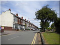
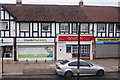
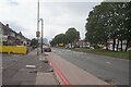
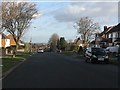
Photos of B26 1PE


Area Information
B26 1PE is a small residential cluster situated within the civil parish of Sheldon, a historic settlement in east Birmingham. Mentioned as Machitone in the Domesday Book of 1086, the area now forms part of the West Midlands region and borders the Metropolitan Borough of Solihull. The postcode covers a population of 1,661 people who live in a quiet, suburban setting close to Acocks Green. Residents enjoy proximity to St Giles Church, a notable 14th-century sandstone structure featuring a 12th-century chancel arch and stained glass by Ward & Hughes. This location offers a peaceful backdrop for those seeking homes in B26 1PE without the intense noise of the city centre. Daily life here is defined by its historical roots and modern convenience, balancing the presence of ancient parish structures with access to nearby rail stations and retail outlets. You will find this area serves as a practical base for living in B26 1PE, combining the stability of a long-established community with straightforward access to wider Birmingham amenities.
- Area Type
- Postcode
- Area Size
- Not available
- Population
- 1661
- Population Density
- 6374 people/km²
The housing market in B26 1PE is defined by a legacy of permanent ownership rather than transient renting. With 68% of homes in the postcode being owner-occupied, this cluster functions as a predominantly owner-occupied area. Houses make up the vast majority of the accommodation type, meaning you will rarely see high-rise blocks or shared flats here. This stock composition contrasts with many parts of modern Birmingham that rely heavily on rental flats. Buyers looking at homes in B26 1PE can expect to find a market driven by purchase intentions rather than short-term leases. The high rate of ownership implies that the current housing stock has seen few recent changes, preserving the original character of the neighbourhood. This stability offers predictability for those considering purchasing a property. The limited population of 1,661 means every house in this cluster is likely to have a long-term resident, making it a quiet environment compared to newer developments.
House Prices in B26 1PE
Showing 1 properties
| Address | Type | Beds | Baths | Last Sale Price | Last Sale Date | |
|---|---|---|---|---|---|---|
| Part First Floor, 1 Manor House Lane, Birmingham, B26 1PE | Office | - | - | - | - |
Energy Efficiency in B26 1PE
Residents of B26 1PE have immediate access to a range of retail and transport hubs within practical reach. For shopping needs, local supermarkets including Tesco Yardley, Iceland Yardley, and Co-op Yardley sit just a short distance away. These outlets provide essential groceries and daily goods without requiring a long journey. Transport links are extensive, with Acocks Green Railway Station, Lea Hall Railway Station, and Olton Railway Station providing rail connections to the city and beyond. Further connectivity is available through Birmingham International Airport, the main Birmingham International Railway Station, and Corporation Street. This mix of amenities means you can easily run local errands while keeping larger destinations within easy commuting range. Living in B26 1PE offers a balance between suburban convenience and urban accessibility.
Amenities
Schools
Families considering schools near B26 1PE will find two strong primary options within easy reach of postcode. Lyndon Green Infant School is listed as a primary establishment with a good Ofsted rating, offering early education for younger children. Further education is provided by Lyndon Green Junior School, which also holds a good Ofsted rating and caters to older primary-age students. This pairing ensures children can attend the Lyndon Green educational campus before moving on to secondary education elsewhere. In addition to these prominent institutions, Brays School is located nearby, operating as a special needs school to support students with additional requirements. The presence of two primary schools with good ratings provides parents with reliable educational choices in the immediate vicinity of their homes.
| Rank | School | Type | Entry gender | Ages |
|---|
Explore more schools in this area
Go to Schools tabDemographics
The community in B26 1PE reflects a settled, mature population with a median age of 47 years. Most residents fall into the 30 to 64-year-old age range, indicating a neighbourhood dominated by adults who have likely settled down. The area maintains a high level of stability, as 68% of households are owner-occupied. This significant proportion suggests that many residents have a long-term connection to the properties they inhabit. Accommodation types consist primarily of houses rather than flats or apartments, reinforcing the character of this suburban cluster. The demographic profile is largely White British, matching the predominant ethnic group recorded for the postcode. These figures paint a picture of a conventional, middle-aged demographic without high levels of transient movement. While the area is not heavily penalised for deprivation, the high ownership rate and age profile suggest a community focused on homeownership and stability. Living in B26 1PE means joining a neighbourhood where permanent residents form the backbone of the local social fabric.
Household Size
Accommodation Type
Tenure
Ethnic Group
Religion
Household Composition
Age
Household Deprivation
NS-SEC
Explore more demographic insights in this area
Go to Demographics tabPlanning
Planning Constraints
- Flood RiskPremium
- Ramsar Wetland SitesPremium
- Area of Outstanding Natural BeautyPremium
- Protected Nature ReservePremium
- Protected WoodlandPremium