Area Overview for B26 1NH
Photos of B26 1NH


Area Information
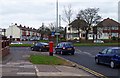
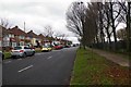
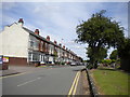
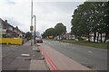
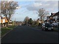
B26 1NH represents a small residential cluster within the wider Sheldon ward, an outer city ward in east Birmingham. The area sits close to the border with the Metropolitan Borough of Solihull, blending suburban comfort with proximity to the city core. This postcode area houses a population of 1,661 residents who enjoy a distinct community life rooted in the area's history. Sheldon was originally recorded as Machitone in the Domesday Book of 1086 and remains known for its historic St Giles Church, which features a 12th-century chancel arch and a 14th-century main structure. Living in this part of Birmingham means residing in a location that has evolved from an ancient parish into a modern home for adults. The setting is defined by its residential nature, offering a peaceful environment without being isolated from urban opportunities. You find yourself in a spot that balances the quiet of a historic village feeling with the practical reach of Birmingham's transport links. The area's identity is anchored by this residential focus and its strong connection to the local heritage surrounding Sheldon Green and the church.
- Area Type
- Postcode
- Area Size
- Not available
- Population
- 1661
- Population Density
- 6374 people/km²
The property market in B26 1NH reflects a traditionally established residential character. Houses are the predominant accommodation type, making this area a prime choice for those seeking detached or semi-detached living spaces. With 68% home ownership rates, the market is heavily skewed towards owner-occupiers rather than private landlords. This high level of ownership typically translates to a stable housing stock where properties have been lived in for many years. Buyers looking at homes in B26 1NH can expect a range of family-sized houses suited to the needs of the local demographic. The concentration of houses and the high ownership percentage indicate a region where residents have invested in local property over the long term. You are likely to encounter a market where selling a home can take time due to the high proportion of existing owners. This dynamic creates a more stable environment but may limit the supply of rental properties available for immediate move-ins. The housing stock is tailored to the needs of the 30-64 age group, featuring layouts that suit families or empty-nesters. When considering homes in this area, you should anticipate a mix of established properties that function well within the current community fabric. The lack of significant social housing provision points to a market driven by private sector transactions and ownership transfers.
House Prices in B26 1NH
No properties found in this postcode.
Energy Efficiency in B26 1NH
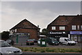
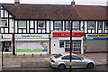
Residents of B26 1NH enjoy convenient access to a variety of retail and transport amenities within practical reach. Locally, Tesco Yardley, Iceland Yardley, and Co-op Yardley serve your shopping requirements, offering groceries and essentials without needing to travel far. Retail options number five establishments in the immediate vicinity, providing daily convenience. For commuting, five railway stations are nearby including Acocks Green Railway Station, Lea Hall Railway Station, and Olton Railway Station. These stations give you direct links into the wider network. You also have access to broader Birmingham connectivity with Birmingham International Airport, Birmingham Intl Railway Station, and Corporation Street available as key Metro points. This network allows you to travel beyond Solihull and into central Birmingham easily. The blend of local shops and public transport hubs means you can balance suburban living with city access. Dining and leisure options are supported by the presence of these major travel and retail centres. Living in this area means having all the daily necessities and transport links you need without excessive travel time.
Amenities
Schools
Families living in B26 1NH have access to two local primary schools with good Ofsted ratings. Lyndon Green Infant School offers early years education in a primary setting, while Lyndon Green Junior School caters to children transitioning into upper key stages. Both institutions hold a good rating, providing reassurance for parents prioritising educational quality. Additionally, Brays School is located nearby and operates as a special school, serving children with special educational needs. This mix of mainstream primary provision and specialist support schools means the area caters to a range of educational requirements. The presence of two linked primary schools, Lyndon Green Infant and Junior, suggests a comprehensive education route for younger children before they move to secondary institutions outside the immediate vicinity. You can rely on local provisions that have been rated well by inspectors. The inclusion of Brays School ensures that resources for special educational needs are physically close to your home. When thinking about schools near B26 1NH, you benefit from a combination of standard primary education and targeted specialist support within a short distance.
| Rank | School | Type | Entry gender | Ages |
|---|
Explore more schools in this area
Go to Schools tabDemographics
The community in B26 1NH is defined by a mature demographic profile with a median age of 47 years. Most residents fall into the adult age range of 30 to 64 years, indicating a neighbourhood populated by established households rather than young couples or retirees. Home ownership is strong here, with 68% of residents owning their properties outright or with a mortgage. This high rate of ownership suggests a stable population that has put down roots in the area. The predominant ethnic group in this community is White, reflecting the demographic composition of much of east Birmingham. Accommodation types are primarily houses, which aligns with the preference for family-friendly or single-family living arrangements in this postcode. You live among neighbours who are likely settled and familiar with the locality. This demographic structure means the area offers a consistent environment for those seeking stability. The focus on ownership over renting points to long-term residents who value their location. Families and professionals in the 30-64 age bracket form the backbone of this neighbourhood, creating a community that values permanence and local integration.
Household Size
Accommodation Type
Tenure
Ethnic Group
Religion
Household Composition
Age
Household Deprivation
NS-SEC
Explore more demographic insights in this area
Go to Demographics tabPlanning
Planning Constraints
- Flood RiskPremium
- Ramsar Wetland SitesPremium
- Area of Outstanding Natural BeautyPremium
- Protected Nature ReservePremium
- Protected WoodlandPremium