Area Overview for B26 1JT
Photos of B26 1JT

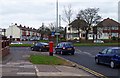
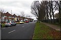
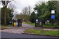
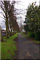
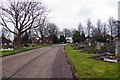
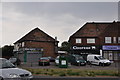
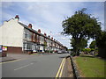
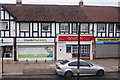

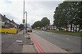
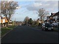
19 photos from this area
Area Information
Key information about the B26 1JT including its size, population, and administrative classification.
- Area Type
- Postcode
- Area Size
- 7976 m²
- Population
- 1645
- Population Density
- 7337 people/km²
House Prices in B26 1JT
26
Properties
£146,414
Average Sold Price
£49,500
Lowest Price
£290,000
Highest Price
Showing 26 properties
| Address | Type | Beds | Baths | Last Sale Price | Last Sale Date | |
|---|---|---|---|---|---|---|
| 51 Gilbertstone Avenue, Birmingham, B26 1JT | Semi-detached | 3 | 1 | £253,000 | Aug 2025 | |
| 41 Gilbertstone Avenue, Birmingham, B26 1JT | Semi-detached | 3 | 2 | £227,000 | Oct 2024 | |
| 81 Gilbertstone Avenue, Birmingham, B26 1JT | Semi-detached | 3 | - | £290,000 | Sep 2024 | |
| 33 Gilbertstone Avenue, Birmingham, B26 1JT | Retail | 3 | 1 | £264,950 | Sep 2022 | |
| 65 Gilbertstone Avenue, Birmingham, B26 1JT | Semi-detached | 3 | - | £220,000 | Sep 2021 | |
| 61 Gilbertstone Avenue, Birmingham, B26 1JT | Semi-detached | 3 | 1 | £180,000 | Dec 2019 | |
| 43 Gilbertstone Avenue, Birmingham, B26 1JT | house | - | - | £159,000 | Jul 2016 | |
| 59 Gilbertstone Avenue, Birmingham, B26 1JT | house | - | - | £135,000 | Nov 2011 | |
| 75 Gilbertstone Avenue, Birmingham, B26 1JT | Semi-detached | 3 | 2 | £134,000 | Mar 2010 | |
| 35 Gilbertstone Avenue, Birmingham, B26 1JT | house | - | - | £115,000 | Sep 2003 |
Page 1 of 3
Energy Efficiency in B26 1JT
Amenities
Schools
| Rank | School | Type | Entry gender | Ages |
|---|
Explore more schools in this area
Go to Schools tabDemographics
Household Size
Family (3-5 people)
most common
Accommodation Type
Houses
most common
Tenure
77
majority
Ethnic Group
White
most common
Religion
N/A
most common
Household Composition
N/A
most common
Age
47
median
Adults (30-64 years)
most common
Household Deprivation
N/A
with no deprivation
NS-SEC
28
in Lower managerial occupations
Explore more demographic insights in this area
Go to Demographics tabPlanning
Planning Constraints
- Flood RiskPremium
- Ramsar Wetland SitesPremium
- Area of Outstanding Natural BeautyPremium
- Protected Nature ReservePremium
- Protected WoodlandPremium