Area Overview for B26 1JG
Photos of B26 1JG


Area Information
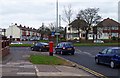
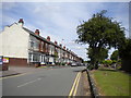
Living in B26 1JG means being part of a small, residential cluster in east Birmingham, England. This postcode area, with a population of 1,661, sits near the border with Solihull and is historically linked to Warwickshire. The community here is defined by its older housing stock, many of which date to the 19th and 20th centuries, reflecting the area’s suburban character. Daily life is shaped by proximity to local amenities, including retail outlets, railway stations, and proximity to Birmingham International Airport. The area’s blend of traditional architecture and practical infrastructure makes it appealing to those seeking a quieter, family-oriented environment within commuting distance of the city. While the population is relatively small, the area’s connectivity to major transport routes and nearby schools ensures it remains accessible for both work and leisure. Its historical roots, including references to the ancient parish of Sheldon, add a layer of local identity, though modern needs are well met by contemporary services and facilities.
- Area Type
- Postcode
- Area Size
- Not available
- Population
- 1661
- Population Density
- 6374 people/km²
The property market in B26 1JG is characterised by a high rate of home ownership (68%), suggesting that most residents are long-term occupants rather than renters. The area is primarily composed of houses, which are more common than flats or apartments. This housing stock likely includes a mix of older, traditional properties and newer builds, though the exact age distribution is not specified. Given the postcode’s small size and the prevalence of owner-occupied homes, the market may be limited in terms of available properties for purchase. Buyers should consider nearby areas for a broader selection, though the existing stock offers stability and potential for long-term investment. The focus on houses over rental properties indicates a community that values private, family-oriented living spaces.
House Prices in B26 1JG
No properties found in this postcode.
Energy Efficiency in B26 1JG
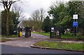
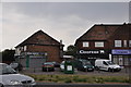
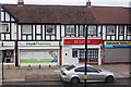
The lifestyle in B26 1JG is shaped by its proximity to retail, transport, and leisure options. Nearby shops include major retailers such as Tesco, Iceland, and Co-op in Yardley, offering everyday essentials. The area’s railway stations—Acocks Green, Lea Hall, and Olton—provide regular services to Birmingham and beyond, while Birmingham International Airport is within reach, facilitating travel. For leisure, the presence of nearby metro points like Corporation Street and Birmingham Intl Railway Station adds convenience. Though specific parks or recreational spaces are not listed, the area’s small size and suburban character suggest a balance between urban amenities and quieter surroundings. The mix of retail, transport, and connectivity ensures daily life is practical, with easy access to shopping, travel, and work opportunities.
Amenities
Schools
Residents of B26 1JG have access to several schools, including Lyndon Green Junior School and Lyndon Green Infant School, both of which hold a good Ofsted rating. These primary schools provide a solid educational foundation for younger children. Additionally, Brays School, a special needs institution, serves the community, offering tailored support for students with specific requirements. The combination of mainstream and special schools reflects a comprehensive educational landscape, catering to a range of needs. For families, this mix ensures options for both general education and specialist support, reducing the need to travel far for schooling. The good Ofsted ratings for the primary schools are a strong indicator of quality, which can be a significant factor for homebuyers prioritising education.
| Rank | School | Type | Entry gender | Ages |
|---|
Explore more schools in this area
Go to Schools tabDemographics
The community in B26 1JG is predominantly composed of adults aged 30–64, with a median age of 47. This suggests a mature, stable population, likely with established careers and families. Home ownership is high at 68%, indicating a strong presence of long-term residents. The area is largely composed of houses, reflecting a preference for detached or semi-detached properties over flats. The predominant ethnic group is White, though specific diversity metrics are not provided. The age profile implies a community with a focus on family life, potentially supporting local schools and amenities. With no data on deprivation levels, it is reasonable to infer that the area’s infrastructure and services align with the needs of its residents, though further local insights might reveal nuances about social dynamics or economic conditions.
Household Size
Accommodation Type
Tenure
Ethnic Group
Religion
Household Composition
Age
Household Deprivation
NS-SEC
Explore more demographic insights in this area
Go to Demographics tabPlanning
Planning Constraints
- Flood RiskPremium
- Ramsar Wetland SitesPremium
- Area of Outstanding Natural BeautyPremium
- Protected Nature ReservePremium
- Protected WoodlandPremium