Area Overview for B26 1JE
Photos of B26 1JE

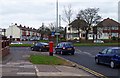
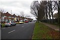
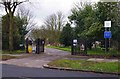
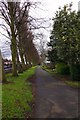
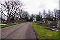
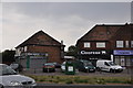
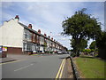
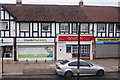
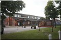
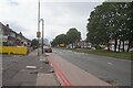
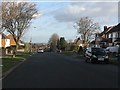
19 photos from this area
Area Information
Key information about the B26 1JE including its size, population, and administrative classification.
- Area Type
- Postcode
- Area Size
- 1.6 hectares
- Population
- 1352
- Population Density
- 7009 people/km²
House Prices in B26 1JE
48
Properties
£145,870
Average Sold Price
£48,900
Lowest Price
£280,000
Highest Price
Showing 48 properties
| Address | Type | Beds | Baths | Last Sale Price | Last Sale Date | |
|---|---|---|---|---|---|---|
| 27 Steyning Road, Birmingham, B26 1JE | Semi-detached | 3 | 1 | £260,000 | Mar 2025 | |
| 44 Steyning Road, Birmingham, B26 1JE | Semi-detached | 3 | 1 | £249,250 | Dec 2022 | |
| 33 Steyning Road, Birmingham, B26 1JE | house | - | - | £201,000 | Feb 2022 | |
| 70 Steyning Road, Birmingham, B26 1JE | house | - | - | £210,000 | Nov 2021 | |
| 25 Steyning Road, Birmingham, B26 1JE | Semi-detached | 3 | 1 | £231,000 | Sep 2021 | |
| 52 Steyning Road, Birmingham, B26 1JE | house | - | - | £196,000 | Mar 2021 | |
| 32 Steyning Road, Birmingham, B26 1JE | house | - | - | £205,000 | Jan 2021 | |
| 39 Steyning Road, Birmingham, B26 1JE | Semi-detached | 3 | 1 | £183,000 | Sep 2019 | |
| 51 Steyning Road, Birmingham, B26 1JE | Semi-detached | 3 | 1 | £150,500 | Mar 2018 | |
| 36 Steyning Road, Birmingham, B26 1JE | Semi-detached | 3 | 1 | £163,000 | Mar 2018 |
Page 1 of 5
Energy Efficiency in B26 1JE
Amenities
Schools
| Rank | School | Type | Entry gender | Ages |
|---|
Explore more schools in this area
Go to Schools tabDemographics
Household Size
Family (3-5 people)
most common
Accommodation Type
Houses
most common
Tenure
80
majority
Ethnic Group
White
most common
Religion
N/A
most common
Household Composition
N/A
most common
Age
47
median
Adults (30-64 years)
most common
Household Deprivation
N/A
with no deprivation
NS-SEC
24
in Lower managerial occupations
Explore more demographic insights in this area
Go to Demographics tabPlanning
Planning Constraints
- Flood RiskPremium
- Ramsar Wetland SitesPremium
- Area of Outstanding Natural BeautyPremium
- Protected Nature ReservePremium
- Protected WoodlandPremium