Area Overview for B26 1HZ
Photos of B26 1HZ


Area Information
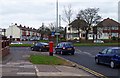
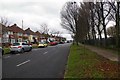
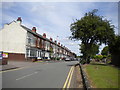
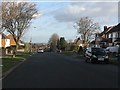
Living in B26 1HZ means being part of a small, residential postcode area in England with a population of 1,661. This cluster of homes is typical of suburban Birmingham, offering a quiet, established community. The area’s character is defined by its mix of traditional housing and proximity to nearby amenities. With a median age of 47 and a majority of residents aged 30–64, the neighbourhood reflects a stable, family-oriented demographic. Daily life here balances local convenience with access to transport links, making it suitable for commuters and those prioritising a settled lifestyle. The area’s compact size means residents are close to essential services, though its small footprint also means limited housing stock. For buyers, this postcode represents a niche market where homes are predominantly owner-occupied, reflecting the 68% home ownership rate. The absence of major environmental constraints, such as protected landscapes or flood risks, adds to its appeal for practical living.
- Area Type
- Postcode
- Area Size
- Not available
- Population
- 1661
- Population Density
- 6374 people/km²
The property market in B26 1HZ is characterised by a high rate of home ownership (68%) and a focus on houses as the primary accommodation type. This suggests a market skewed towards owner-occupied homes rather than rentals, which may limit availability for buyers seeking short-term or flexible housing. The small size of the postcode area means the housing stock is limited, and buyers should consider the immediate surroundings for more options. The predominance of houses indicates a preference for private, detached properties, which may appeal to those prioritising space and privacy. However, the compact nature of the area also means competition for properties could be intense, particularly for those seeking newer builds or specific features. For buyers, the market offers a stable, low-risk investment, though the limited supply may require a broader search beyond the postcode itself.
House Prices in B26 1HZ
No properties found in this postcode.
Energy Efficiency in B26 1HZ
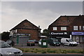
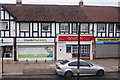
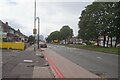
Residents of B26 1HZ have access to a range of local amenities within practical reach. The retail sector includes well-known stores such as Tesco Yardley, Iceland Yardley, and Co-op Yardley, offering everyday shopping needs. These stores are conveniently located for residents, reducing the need for long trips to larger centres. The rail network provides access to nearby stations, connecting the area to broader regional services and the Birmingham International Airport. While the area itself is small, the surrounding infrastructure ensures that residents can access leisure, dining, and other services without significant travel. The mix of retail, transport, and proximity to schools creates a self-contained lifestyle, ideal for those seeking convenience without the pressures of urban density. The character of the area is defined by its practicality, with amenities that cater to daily living without overwhelming the community.
Amenities
Schools
Residents of B26 1HZ have access to a range of educational institutions, including Lyndon Green Junior School and Lyndon Green Infant School, both of which hold a good Ofsted rating. These primary schools provide a solid foundation for younger children, with their positive evaluations reflecting effective teaching and facilities. The area also includes Brays School, a special educational institution, which caters to students with specific learning needs. This mix of school types ensures families can find options that align with their children’s requirements, whether for mainstream education or specialist support. The proximity of these schools to the postcode area means parents can reasonably expect a commute of less than 15 minutes, enhancing the area’s appeal for families. The presence of both primary and special schools suggests a community that values inclusive education and supports diverse learning needs.
| Rank | School | Type | Entry gender | Ages |
|---|
Explore more schools in this area
Go to Schools tabDemographics
The community in B26 1HZ is predominantly composed of adults aged 30–64, with a median age of 47. This suggests a mature, established population, likely with strong ties to local institutions and a focus on long-term residency. Home ownership is high, with 68% of residents living in their own homes, and the primary accommodation type is houses, indicating a preference for private, detached living. The predominant ethnic group is White, though no further breakdown of diversity is provided. The population size of 1,661 means the area is small enough to foster a close-knit community but not so dense as to feel overcrowded. The absence of specific deprivation data means the quality of life is inferred from the area’s stability and infrastructure. With no significant environmental or planning constraints, the area is well-suited for families and professionals seeking a balanced, low-risk environment.
Household Size
Accommodation Type
Tenure
Ethnic Group
Religion
Household Composition
Age
Household Deprivation
NS-SEC
Explore more demographic insights in this area
Go to Demographics tabPlanning
Planning Constraints
- Flood RiskPremium
- Ramsar Wetland SitesPremium
- Area of Outstanding Natural BeautyPremium
- Protected Nature ReservePremium
- Protected WoodlandPremium