Area Overview for B26 1BL
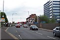
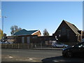
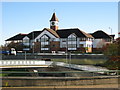
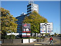
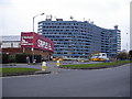
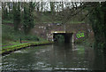
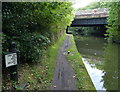
Photos of B26 1BL


Area Information
B26 1BL is a small, residential postcode area in east Birmingham, nestled within the broader Yardley ward. With a population of 1,597, it reflects a tight-knit community just 3.5 miles from the city centre, offering a blend of historical roots and modern living. The area’s name traces back to the Domesday Book, yet today it is defined by its proximity to transport hubs, retail centres, and green spaces. Residents benefit from easy access to multiple railway stations, including Acocks Green and Tyseley, and are within reach of Birmingham International Airport. The postcode’s compact size means daily life is centred on nearby amenities, from supermarkets like Tesco Yardley to local parks and community hubs. While the area has seen 20th-century transformations, including council estates and road upgrades, it retains a distinct character shaped by its history as part of the former Worcestershire district. For buyers, B26 1BL offers a manageable, well-connected slice of Birmingham, ideal for those seeking a balance between urban convenience and suburban tranquillity.
- Area Type
- Postcode
- Area Size
- Not available
- Population
- 1597
- Population Density
- 3526 people/km²
B26 1BL’s property market is shaped by its predominantly owner-occupied nature, with 47% of homes owned by residents. The accommodation type is largely houses, which contrasts with the higher-density housing typical of inner-city areas. This suggests a market skewed towards family homes rather than apartments or flats, offering buyers a range of semi-detached or terraced properties. The small postcode area means the housing stock is limited, and buyers may need to consider nearby wards for more options. The presence of multiple rail links, including Acocks Green and Tyseley stations, enhances the area’s appeal for commuters, though property prices may reflect proximity to transport. Given the modest home ownership rate, the market may also cater to renters or those seeking long-term investment in a stable, low-risk area. For buyers, B26 1BL presents a niche opportunity to purchase in a well-connected, residential postcode with clear boundaries and a defined character.
House Prices in B26 1BL
No properties found in this postcode.
Energy Efficiency in B26 1BL
B26 1BL’s residents have access to a range of amenities within easy reach, from retail to transport. The area includes five notable retail outlets, such as Tesco Yardley and Co-op Yardley, ensuring everyday shopping needs are met without long commutes. For transport, five railway stations, including Acocks Green and Tyseley, provide regular links to Birmingham’s core and surrounding areas. Birmingham International Airport is also nearby, offering convenience for travel. The presence of multiple metro points, like Corporation Street, adds to the area’s connectivity. While parks and leisure facilities are not explicitly listed in the data, the proximity to historic sites like the Swan underpass and the broader Yardley area’s green spaces suggest opportunities for outdoor activities. This mix of retail, transport, and historical context creates a lifestyle that balances practicality with a touch of local heritage.
Amenities
Schools
The nearest school to B26 1BL is the East Birmingham Network Academy, categorised as an ‘other’ school type. While no Ofsted rating is provided, its presence indicates access to secondary education within the area. Families relying on this school may benefit from its proximity, reducing travel time for students. However, the absence of primary schools or additional educational institutions in the data suggests that parents may need to look beyond the immediate postcode for comprehensive schooling options. The mix of school types is limited here, meaning buyers should consider the broader Yardley area for a wider range of educational facilities. For those prioritising schools as a key factor, B26 1BL’s current offerings are modest, requiring careful planning for long-term family needs.
| Rank | School | Type | Entry gender | Ages |
|---|
Explore more schools in this area
Go to Schools tabDemographics
The population of B26 1BL is predominantly adults aged 30–64, with a median age of 47. This suggests a mature, settled community with strong ties to the area. Home ownership stands at 47%, slightly below the national average, indicating a mix of owner-occupied properties and rental units. The primary accommodation type is houses, which aligns with the area’s residential character. The predominant ethnic group is White, reflecting broader trends in Birmingham’s outer suburbs. While no specific deprivation data is provided, the age profile and housing stock suggest a stable demographic with limited generational turnover. The presence of multiple railway stations and retail amenities nearby supports a lifestyle that prioritises accessibility over high-density living. This profile makes B26 1BL appealing to families and professionals seeking a quieter alternative to central Birmingham, though the relatively low home ownership rate may indicate a reliance on rental markets or shared housing.
Household Size
Accommodation Type
Tenure
Ethnic Group
Religion
Household Composition
Age
Household Deprivation
NS-SEC
Explore more demographic insights in this area
Go to Demographics tabPlanning
Planning Constraints
- Flood RiskPremium
- Ramsar Wetland SitesPremium
- Area of Outstanding Natural BeautyPremium
- Protected Nature ReservePremium
- Protected WoodlandPremium