Area Overview for B26 1AE
Photos of B26 1AE


Area Information
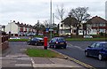
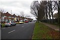
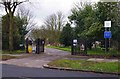
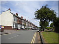
Living in B26 1AE means being part of a small, tightly knit residential cluster in South Yardley, east Birmingham. With a population of 1,352, this area is characterised by its proximity to the city centre—just 6 km away—and its historical roots, once encompassing parts of Hay Mills and Tyseley. The community here is predominantly middle-aged, with a median age of 47, and a strong presence of households aged 30–64. Daily life is shaped by the area’s blend of residential stability and practical connectivity, with easy access to rail networks and retail hubs. The postcode sits within a broader ward that has evolved from 19th-century industrial activity to modern housing, reflecting a balance between heritage and contemporary needs. Residents benefit from proximity to Birmingham International Airport and multiple railway stations, while the area’s low flood risk and absence of protected natural sites ensure a straightforward living environment. This is a place where convenience meets a sense of rootedness, ideal for those seeking a quieter, family-oriented lifestyle near urban amenities.
- Area Type
- Postcode
- Area Size
- Not available
- Population
- 1352
- Population Density
- 7009 people/km²
The property market in B26 1AE is dominated by owner-occupied homes, with 80% of residents living in houses rather than rented accommodation. This indicates a stable, long-term demographic and a focus on family-friendly housing. The prevalence of houses suggests a market tailored to those seeking space and privacy, rather than high-density living. Given the area’s small size, the housing stock is limited, which may influence property values and availability. Proximity to Birmingham’s transport networks, including multiple railway stations and the M6 motorway, adds to the area’s appeal for commuters. For buyers, this means a market where properties are likely to hold value, though the small postcode area means competition could be fierce. The mix of residential and historical features also offers potential for those seeking characterful homes near urban amenities.
House Prices in B26 1AE
No properties found in this postcode.
Energy Efficiency in B26 1AE
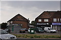
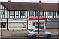
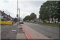
Residents of B26 1AE enjoy a range of amenities within practical reach, from essential retail to transport hubs. The nearby Tesco Yardley, Iceland Yardley, and Co-op Yardley provide everyday shopping convenience, while the area’s rail network—featuring Acocks Green, Tyseley, and Olton stations—offers direct access to Birmingham’s city centre and regional destinations. Proximity to Birmingham International Airport and Corporation Street adds to the area’s appeal for both travel and work. Though the data does not mention parks or leisure facilities, the absence of protected natural sites suggests a focus on residential and commercial infrastructure. The character of daily life here is defined by accessibility: a short journey from urban hubs, yet a distinct residential feel. The blend of retail, transport, and proximity to the city ensures a lifestyle that balances convenience with a quieter, community-oriented environment.
Amenities
Schools
| Rank | School | Type | Entry gender | Ages |
|---|
Explore more schools in this area
Go to Schools tabDemographics
The demographic profile of B26 1AE is defined by a median age of 47, with the majority of residents falling within the 30–64 age range. This suggests a community of established professionals and families, rather than a transient population. Home ownership is high at 80%, indicating a stable, long-term resident base. The accommodation type is primarily houses, reflecting a preference for larger, private living spaces over flats. The predominant ethnic group is White, though the data does not provide further breakdowns. With a population of 1,352, the area is small enough to foster a close-knit community but large enough to support essential services. The absence of specific deprivation data means that quality of life is likely influenced by the area’s infrastructure, such as its rail links and retail options. This demographic mix suggests a neighbourhood that values security, familiarity, and proximity to urban centres.
Household Size
Accommodation Type
Tenure
Ethnic Group
Religion
Household Composition
Age
Household Deprivation
NS-SEC
Explore more demographic insights in this area
Go to Demographics tabPlanning
Planning Constraints
- Flood RiskPremium
- Ramsar Wetland SitesPremium
- Area of Outstanding Natural BeautyPremium
- Protected Nature ReservePremium
- Protected WoodlandPremium