Area Overview for B25 9GR
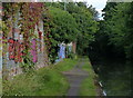
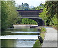
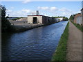
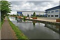
Photos of B25 9GR


Area Information
Living in B25 9GR, part of Tyseley and Hay Mills in Birmingham, means inhabiting a historically industrialised area with a distinct character. This small postcode covers a residential cluster adjacent to Small Heath and South Yardley, bisected by the A45 Coventry Road. The population of 1,789 reflects a mature community, with a median age of 47 and a majority of residents aged 30–64. The area’s heritage is rooted in manufacturing, from 19th-century wire-drawing mills to modern green energy initiatives at Tyseley Energy Park. Daily life here balances proximity to urban amenities with a quieter, residential feel. The ward’s boundaries are defined by the River Cole, the Grand Union Canal, and roads like the A4040, creating a compact, well-defined neighbourhood. While historically part of Worcestershire, it has been integral to Birmingham’s growth since 1911. Residents benefit from a mix of historical sites, such as Grade II-listed Hay Hall, and contemporary developments like the Tyseley Environmental Enterprise District, which positions the area as a hub for innovation.
- Area Type
- Postcode
- Area Size
- Not available
- Population
- 1789
- Population Density
- 2149 people/km²
The property market in B25 9GR is characterised by a 50% home ownership rate, suggesting a balance between owner-occupied properties and rental stock. The primary accommodation type is houses, which are likely to be family homes given the area’s mature demographic. This mix of ownership and rental options means buyers should consider the limited scale of the area, which may restrict availability. The presence of houses rather than flats or apartments implies a focus on traditional, spacious living, potentially appealing to those seeking larger homes. However, the small size of the postcode and its immediate surroundings could mean competition for properties. Buyers should also note the historical industrial legacy of the area, which may influence property character and value. While the data does not specify price ranges, the mix of residential and former industrial sites, such as Tyseley Energy Park, may offer unique opportunities for those seeking properties with potential for renovation or development.
House Prices in B25 9GR
No properties found in this postcode.
Energy Efficiency in B25 9GR
Daily life in B25 9GR is enriched by a range of nearby amenities. Residents have access to five retail outlets, including Iceland Heybarnes, Lidl Yardley, and Asda Merestones, ensuring convenient shopping options. The area’s transport links also provide access to metro stations like Corporation Street and Bull Street, which connect to Birmingham’s vibrant city centre. While the data does not specify parks or leisure facilities, the presence of historical sites like Hay Hall and modern developments such as Tyseley Energy Park suggests a blend of heritage and innovation. The area’s industrial past, including former wire-drawing mills and the Tyseley Traction Maintenance Depot, adds a unique character to its landscape. The compact size of the postcode means amenities are within practical reach, though specific details about dining or recreational options are not provided. Overall, the combination of retail, transport, and historical significance offers a lifestyle that balances convenience with a sense of place.
Amenities
Schools
| Rank | School | Type | Entry gender | Ages |
|---|
Explore more schools in this area
Go to Schools tabDemographics
The community in B25 9GR is predominantly composed of adults aged 30–64, with a median age of 47. This suggests a mature, established population, likely with strong ties to the area. Home ownership rates stand at 50%, indicating a balanced mix of owner-occupied and rental properties. The accommodation type is primarily houses, which may reflect a preference for family homes in this residential cluster. The predominant ethnic group is White, aligning with broader demographic trends in the region. With a population of 1,789, the area is small enough to foster a close-knit community but large enough to support essential services. The absence of detailed deprivation data means no specific conclusions can be drawn about economic challenges, though the 50% home ownership rate suggests a stable housing market. This profile indicates a community focused on long-term residency, with a mix of working-age adults and retirees contributing to its social fabric.
Household Size
Accommodation Type
Tenure
Ethnic Group
Religion
Household Composition
Age
Household Deprivation
NS-SEC
Explore more demographic insights in this area
Go to Demographics tabPlanning
Planning Constraints
- Flood RiskPremium
- Ramsar Wetland SitesPremium
- Area of Outstanding Natural BeautyPremium
- Protected Nature ReservePremium
- Protected WoodlandPremium