Area Overview for B25 8XL
Photos of B25 8XL
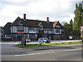
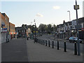
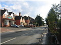
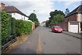
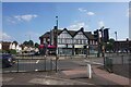
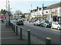
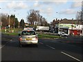
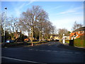
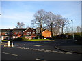
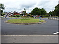
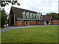
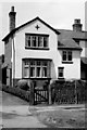
15 photos from this area
Area Information
Key information about the B25 8XL including its size, population, and administrative classification.
- Area Type
- Postcode
- Area Size
- 8462 m²
- Population
- 1738
- Population Density
- 4530 people/km²
House Prices in B25 8XL
27
Properties
£206,115
Average Sold Price
£114,000
Lowest Price
£335,000
Highest Price
Showing 27 properties
| Address | Type | Beds | Baths | Last Sale Price | Last Sale Date | |
|---|---|---|---|---|---|---|
| 301 Church Road, Stechford And Yardley North, Birmingham, B25 8XL | Detached | 3 | 2 | £256,000 | Jul 2025 | |
| 234 Church Road, Stechford And Yardley North, Birmingham, B25 8XL | Terraced | 2 | 1 | £156,000 | Nov 2024 | |
| 242 Church Road, Stechford And Yardley North, Birmingham, B25 8XL | Semi-detached | 3 | 2 | £221,500 | Nov 2022 | |
| 246 Church Road, Stechford And Yardley North, Birmingham, B25 8XL | Semi-detached | 3 | 1 | £280,000 | Nov 2022 | |
| 252 Church Road, Stechford And Yardley North, Birmingham, B25 8XL | Retail | 3 | - | £285,000 | Sep 2022 | |
| 283 Church Road, Stechford And Yardley North, Birmingham, B25 8XL | Cottage | 3 | 1 | £335,000 | Aug 2022 | |
| 248 Church Road, Stechford And Yardley North, Birmingham, B25 8XL | Retail | 3 | 1 | £290,000 | Jun 2022 | |
| 230 Church Road, Stechford And Yardley North, Birmingham, B25 8XL | Unknown | - | - | £115,000 | Jun 2018 | |
| 250 Church Road, Stechford And Yardley North, Birmingham, B25 8XL | Semi-detached | 3 | - | £174,000 | Aug 2017 | |
| 297 Church Road, Stechford And Yardley North, Birmingham, B25 8XL | house | - | - | £163,000 | Oct 2015 |
Page 1 of 3
Energy Efficiency in B25 8XL
Amenities
Schools
| Rank | School | Type | Entry gender | Ages |
|---|
Explore more schools in this area
Go to Schools tabDemographics
Household Size
One person
most common
Accommodation Type
Houses
most common
Tenure
73
majority
Ethnic Group
White
most common
Religion
N/A
most common
Household Composition
N/A
most common
Age
47
median
Adults (30-64 years)
most common
Household Deprivation
N/A
with no deprivation
NS-SEC
29
in Lower managerial occupations
Explore more demographic insights in this area
Go to Demographics tabPlanning
Planning Constraints
- Flood RiskPremium
- Ramsar Wetland SitesPremium
- Area of Outstanding Natural BeautyPremium
- Protected Nature ReservePremium
- Protected WoodlandPremium