Area Overview for B25 8NB
Photos of B25 8NB
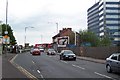
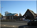
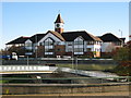
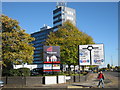


79 photos from this area
Area Information
Key information about the B25 8NB including its size, population, and administrative classification.
- Area Type
- Postcode
- Area Size
- 1.8 hectares
- Population
- 1728
- Population Density
- 3774 people/km²
House Prices in B25 8NB
53
Properties
£132,138
Average Sold Price
£36,500
Lowest Price
£324,000
Highest Price
Showing 53 properties
| Address | Type | Beds | Baths | Last Sale Price | Last Sale Date | |
|---|---|---|---|---|---|---|
| 435 Yardley Road, South Yardley, Birmingham, B25 8NB | house | 4 | 2 | £324,000 | Feb 2025 | |
| 375 Yardley Road, South Yardley, Birmingham, B25 8NB | house | 1 | 1 | £145,000 | Feb 2023 | |
| 415 Yardley Road, South Yardley, Birmingham, B25 8NB | Terraced | 3 | 1 | £92,500 | Oct 2022 | |
| 397 Yardley Road, South Yardley, Birmingham, B25 8NB | Terraced | 2 | 1 | £170,000 | Aug 2022 | |
| 419 Yardley Road, South Yardley, Birmingham, B25 8NB | house | - | - | £155,000 | Mar 2021 | |
| 373 Yardley Road, South Yardley, Birmingham, B25 8NB | Terraced | 1 | 1 | £176,000 | Jan 2021 | |
| 393 Yardley Road, South Yardley, Birmingham, B25 8NB | house | - | - | £150,000 | Sep 2020 | |
| 413 Yardley Road, South Yardley, Birmingham, B25 8NB | house | - | - | £78,000 | Jun 2020 | |
| 439 Yardley Road, South Yardley, Birmingham, B25 8NB | Terraced | 3 | 1 | £155,000 | Mar 2020 | |
| 437 Yardley Road, South Yardley, Birmingham, B25 8NB | Semi-detached | 3 | 1 | £156,000 | Nov 2019 |
Page 1 of 6
Energy Efficiency in B25 8NB
Amenities
Schools
| Rank | School | Type | Entry gender | Ages |
|---|
Explore more schools in this area
Go to Schools tabDemographics
Household Size
Family (3-5 people)
most common
Accommodation Type
Houses
most common
Tenure
53
majority
Ethnic Group
White
most common
Religion
N/A
most common
Household Composition
N/A
most common
Age
47
median
Adults (30-64 years)
most common
Household Deprivation
N/A
with no deprivation
NS-SEC
16
in Lower managerial occupations
Explore more demographic insights in this area
Go to Demographics tabPlanning
Planning Constraints
- Flood RiskPremium
- Ramsar Wetland SitesPremium
- Area of Outstanding Natural BeautyPremium
- Protected Nature ReservePremium
- Protected WoodlandPremium