Area Overview for B25 8DB
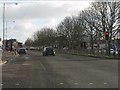
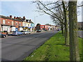
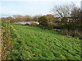
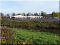
Photos of B25 8DB


Area Information
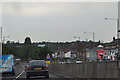
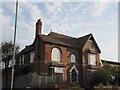
Living in B25 8DB means inhabiting a small, defined residential cluster in the east of Birmingham, England. The area, part of the Tyseley and Hay Mills ward, sits adjacent to Small Heath and South Yardley, bisected by the A45 Coventry Road. With a population of 2,209, it is a compact community shaped by historical industrial activity. The area’s name derives from Old English, reflecting its medieval roots as fenced land near Hay Hall, a 15th-century Grade II listed hall. Today, B25 8DB balances its industrial heritage with modern infrastructure, including the Tyseley Energy Park, a hub for green energy innovation. Residents benefit from proximity to rail networks and retail hubs, though the area’s character is defined by its compact scale and historical layers. The ward’s boundaries are marked by the River Cole and the Grand Union Canal, creating a mix of urban and semi-natural environments. While the population is young, with a median age of 22, the community’s diversity is notable, with Asian communities forming the predominant ethnic group. Living here offers a blend of practical connectivity and historical depth, though the small size means limited expansion.
- Area Type
- Postcode
- Area Size
- Not available
- Population
- 2209
- Population Density
- 3163 people/km²
The property market in B25 8DB is defined by a 35% home ownership rate, with houses being the predominant accommodation type. This suggests a mix of owner-occupied homes and rental properties, though the small population size means the market is limited in scale. The focus on houses, rather than flats or apartments, indicates a preference for single-family dwellings, which may appeal to families or those seeking more space. However, the low home ownership rate implies that a significant portion of the housing stock is rented, potentially offering opportunities for buyers seeking entry-level properties. The area’s compact nature means that property values may be influenced by proximity to amenities such as schools, transport links, and retail hubs. Buyers should consider the limited expansion potential in such a small postcode, with immediate surroundings likely to be similarly developed. The presence of industrial heritage sites, like Tyseley Energy Park, may also affect property desirability, blending practicality with historical context.
House Prices in B25 8DB
No properties found in this postcode.
Energy Efficiency in B25 8DB
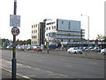
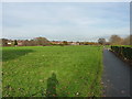
The lifestyle in B25 8DB is shaped by its proximity to retail, rail, and community hubs. Nearby amenities include five retail outlets, such as Iceland Heybarnes and Lidl Yardley, offering everyday shopping convenience. The area’s rail network is well-connected, with stations like Tyseley and Acocks Green providing access to Birmingham’s broader transport system. Metro stations such as Corporation Street and Bull Street further enhance mobility, linking residents to the city’s business and cultural centres. While the data does not specify parks or leisure facilities, the historical presence of the Tyseley Traction Maintenance Depot and the nearby Tyseley Energy Park suggest a mix of industrial heritage and modern innovation. The compact nature of the area means that daily life is centred around local shops, transport nodes, and the surrounding industrial and residential zones. This creates a practical, no-frills lifestyle, ideal for those prioritising accessibility over expansive green spaces.
Amenities
Schools
The nearest school to B25 8DB is Redhill Primary School, a primary institution with a good Ofsted rating. This rating indicates that the school meets national standards in teaching quality, pupil outcomes, and leadership. For families, the presence of a primary school with a good rating is a key consideration, though the data does not mention secondary schools or other educational institutions. The single primary school suggests that parents may need to look beyond the immediate area for secondary education options. The school’s performance reflects positively on the community’s commitment to education, though the limited number of schools may impact choices for larger families or those requiring specialist provisions. Overall, the availability of a well-rated primary school is a practical advantage for residents prioritising quality education for younger children.
| Rank | School | Type | Entry gender | Ages |
|---|
Explore more schools in this area
Go to Schools tabDemographics
The population of B25 8DB is 2,209, with a median age of 22, indicating a predominantly young demographic. The most common age range is adults aged 30–64, suggesting a mix of working-age residents and families. Home ownership stands at 35%, lower than the national average, pointing to a community where rental properties may be more prevalent. The accommodation type is primarily houses, contrasting with higher-density housing in larger cities. The predominant ethnic group is Asian, reflecting the area’s cultural diversity. This demographic profile shapes daily life, with a focus on family-oriented living and community engagement. The relatively low home ownership rate may influence local dynamics, potentially fostering a more transient population. However, the presence of a primary school with a good Ofsted rating and proximity to rail networks suggests the area is functional for families. The data does not indicate deprivation levels, but the combination of young residents and moderate home ownership may imply a mix of economic profiles, from students to early-career professionals.
Household Size
Accommodation Type
Tenure
Ethnic Group
Religion
Household Composition
Age
Household Deprivation
NS-SEC
Explore more demographic insights in this area
Go to Demographics tabPlanning
Planning Constraints
- Flood RiskPremium
- Ramsar Wetland SitesPremium
- Area of Outstanding Natural BeautyPremium
- Protected Nature ReservePremium
- Protected WoodlandPremium