Area Overview for B25 8BQ
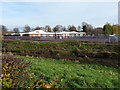
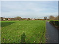
Photos of B25 8BQ


Area Information
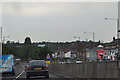
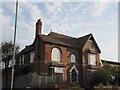
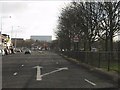
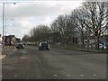
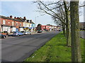
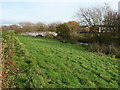
Living in B25 8BQ means inhabiting a small residential cluster in east Birmingham, historically part of Worcestershire before its incorporation into Birmingham in 1911. The area, known as Tyseley and Hay Mills, is defined by its proximity to the A45 Coventry Road, which bisects the ward. With a population of nearly 2,000, it is a compact community shaped by industrial heritage and modern innovation. The area’s name derives from Old English *gehaeg*, reflecting its origins as fenced land with a moated house, Hay Hall, dating to the 13th century. Today, B25 8BQ is part of Birmingham’s Tyseley Environmental Enterprise District, a hub for green energy and innovation. The legacy of manufacturing, such as Webster Horsfall’s piano wire production, still lingers, though the area now hosts Tyseley Energy Park, a focal point for sustainable development. Residents benefit from proximity to rail networks and retail hubs like Yardley, offering a blend of historical character and practical connectivity.
- Area Type
- Postcode
- Area Size
- Not available
- Population
- 1999
- Population Density
- 5065 people/km²
The property market in B25 8BQ is characterised by a 58% home ownership rate, with houses forming the majority of accommodation types. This suggests a focus on owner-occupied homes rather than a rental market, though the small population and limited data mean the rental sector remains unclear. The presence of houses implies a mix of family homes and larger properties, potentially appealing to buyers seeking space in a compact area. Given the ward’s historical industrial roots, properties may retain architectural features from the 19th and 20th centuries, blending heritage with modern needs. However, the small size of the area means buyers should consider nearby neighbourhoods for broader options. The market’s stability is likely influenced by proximity to transport links and the area’s designation as an environmental enterprise zone, which could attract investors interested in sustainable development.
House Prices in B25 8BQ
No properties found in this postcode.
Energy Efficiency in B25 8BQ
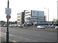
Residents of B25 8BQ have access to nearby retail options, including Lidl, Farmfoods, and Tesco in Yardley, providing everyday shopping convenience. The area’s rail and metro stations—Tyseley, Acocks Green, Small Heath, and Corporation Street—offer easy access to Birmingham’s city centre, universities, and employment hubs. While specific parks or leisure facilities are not detailed in the data, the proximity to the A45 and rail networks suggests opportunities for outdoor activities in nearby green spaces. The historical industrial character of the area contrasts with modern amenities, creating a balance between practicality and heritage. The presence of Tyseley Energy Park also hints at a growing focus on innovation and sustainability, potentially influencing local events or community projects. Overall, the lifestyle in B25 8BQ combines accessibility with a sense of rootedness in a historically significant part of Birmingham.
Amenities
Schools
| Rank | School | Type | Entry gender | Ages |
|---|
Explore more schools in this area
Go to Schools tabDemographics
B25 8BQ has a median age of 47, with the majority of residents aged 30–64. This suggests a mature, stable population, likely with established careers and family structures. Home ownership stands at 58%, slightly below the national average, with houses being the predominant accommodation type. The area’s demographic profile indicates a community that values settled living, though the relatively low home ownership rate may reflect a mix of owner-occupied and rented properties. The predominant ethnic group is Asian, which shapes the cultural and social fabric of the area. With a population of 1,999, the community is small enough to foster familiarity but large enough to support local amenities. The age distribution and ownership figures suggest a balance between long-term residents and those seeking affordable housing in a historically industrialised zone.
Household Size
Accommodation Type
Tenure
Ethnic Group
Religion
Household Composition
Age
Household Deprivation
NS-SEC
Explore more demographic insights in this area
Go to Demographics tabPlanning
Planning Constraints
- Flood RiskPremium
- Ramsar Wetland SitesPremium
- Area of Outstanding Natural BeautyPremium
- Protected Nature ReservePremium
- Protected WoodlandPremium