Area Overview for B24 9SL
Photos of B24 9SL
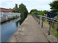
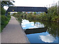
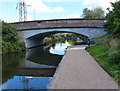
47 photos from this area
Area Information
Key information about the B24 9SL including its size, population, and administrative classification.
- Area Type
- Postcode
- Area Size
- 5515 m²
- Population
- 1615
- Population Density
- 844 people/km²
House Prices in B24 9SL
20
Properties
£82,925
Average Sold Price
£38,000
Lowest Price
£140,000
Highest Price
Showing 20 properties
| Address | Type | Beds | Baths | Last Sale Price | Last Sale Date | |
|---|---|---|---|---|---|---|
| 138 Round Road, Birmingham, B24 9SL | house | 2 | - | £140,000 | Dec 2023 | |
| 137 Round Road, Birmingham, B24 9SL | Terraced | 3 | 1 | £90,000 | Nov 2016 | |
| 136 Round Road, Birmingham, B24 9SL | Terraced | 3 | - | £104,000 | Mar 2014 | |
| 132 Round Road, Birmingham, B24 9SL | house | 2 | - | £80,000 | Feb 2011 | |
| 135 Round Road, Birmingham, B24 9SL | Semi-detached | - | - | £99,950 | Apr 2004 | |
| 131 Round Road, Birmingham, B24 9SL | house | - | - | £69,950 | Jan 2003 | |
| 130 Round Road, Birmingham, B24 9SL | Terraced | - | - | £41,500 | Jan 2001 | |
| 129 Round Road, Birmingham, B24 9SL | Terraced | 3 | - | £38,000 | Feb 1998 | |
| 124 Round Road, Birmingham, B24 9SL | Terraced | - | - | - | - | |
| 128 Round Road, Birmingham, B24 9SL | Terraced | - | - | - | - |
Page 1 of 2
Energy Efficiency in B24 9SL
Amenities
Schools
| Rank | School | Type | Entry gender | Ages |
|---|
Explore more schools in this area
Go to Schools tabDemographics
Household Size
Family (3-5 people)
most common
Accommodation Type
Houses
most common
Tenure
49
majority
Ethnic Group
White
most common
Religion
N/A
most common
Household Composition
N/A
most common
Age
47
median
Adults (30-64 years)
most common
Household Deprivation
N/A
with no deprivation
NS-SEC
18
in Lower managerial occupations
Explore more demographic insights in this area
Go to Demographics tabPlanning
Planning Constraints
- Flood RiskPremium
- Ramsar Wetland SitesPremium
- Area of Outstanding Natural BeautyPremium
- Protected Nature ReservePremium
- Protected WoodlandPremium