Area Overview for B24 9SG
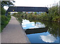
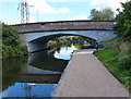
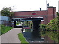
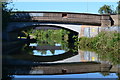
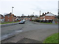
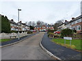
Photos of B24 9SG


Area Information
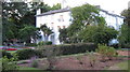
B24 9SG is a small residential postcode area nestled within the broader Erdington district of Birmingham, a historic village that evolved into a suburban hub. With a population of 1,712, this compact cluster offers a quiet, community-focused lifestyle. Erdington’s origins trace back to the 9th century, with roots along the River Tame and Roman roads, now reflected in landmarks like Chester Road and the former Erdington Hall. Daily life here balances suburban convenience with historical character. Residents benefit from proximity to Erdington High Street, a major retail corridor, and transport links including rail and metro stations. The area’s compact size means amenities are within practical reach, while its location near Birmingham’s core ensures access to urban opportunities. Though modest in scale, B24 9SG combines traditional housing stock with modern infrastructure, appealing to those seeking a settled, low-traffic environment without sacrificing connectivity.
- Area Type
- Postcode
- Area Size
- Not available
- Population
- 1712
- Population Density
- 6482 people/km²
B24 9SG’s property market is characterised by a 49% home ownership rate, indicating a balance between owner-occupied and rental properties. The accommodation type is predominantly houses, aligning with the suburban nature of Erdington. This suggests a market skewed towards family homes rather than apartments or flats, which may appeal to buyers seeking traditional living spaces. Given the area’s small size, property availability is likely limited, with competition potentially higher for desirable homes. The presence of nearby amenities and transport links could enhance the area’s appeal, though buyers should consider the limited scale of the postcode when assessing options. The mix of ownership and rental properties may offer flexibility, but the overall market remains niche, requiring careful evaluation of local demand and supply.
House Prices in B24 9SG
No properties found in this postcode.
Energy Efficiency in B24 9SG
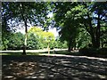
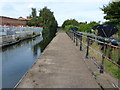
Residents of B24 9SG have access to a range of amenities within practical reach. Retail options include Farmfoods Erdington, Iceland Erdington, and Tesco Erdington, providing everyday shopping convenience. Public transport is well-served by rail and metro stations, including Gravelly Hill Railway Station and St Chads Metro Stop, enabling easy travel to Birmingham’s commercial and cultural centres. Leisure opportunities include parks such as Rookery Park, a former district office turned green space, and Brookvale Park Lake, a former reservoir offering recreational activities. The area’s mix of retail, transport, and green spaces contributes to a balanced lifestyle, blending suburban tranquillity with urban accessibility.
Amenities
Schools
The nearest school to B24 9SG is Glenthorne Centre, categorised as an "other" type in the data. No Ofsted rating is provided, so its academic performance or facilities cannot be assessed here. The limited school options suggest families may need to look beyond the immediate area for broader educational choices. The absence of primary or secondary schools listed indicates that residents might rely on nearby institutions in Erdington or surrounding suburbs. For families prioritising local schooling, this could be a consideration, though the exact quality and range of educational provision remain unclear without further details.
| Rank | A + A* % | School | Type | Entry gender | Ages |
|---|---|---|---|---|---|
| 1 | N/A | Glenthorne Centre | other | N/A | N/A |
Explore more schools in this area
Go to Schools tabDemographics
The population of B24 9SG has a median age of 47, with the majority of residents aged 30–64. This suggests a mature, stable community with a strong presence of working-age adults. Home ownership stands at 49%, slightly below the national average, indicating a mix of owner-occupied and rental properties. The primary accommodation type is houses, reflecting a suburban character rather than high-density living. The predominant ethnic group is White, though specific data on diversity or deprivation is not available. This age profile and housing mix suggest a community focused on family living and long-term residency. The absence of detailed diversity metrics means broader social dynamics remain less defined, but the demographic stability points to a relatively cohesive local environment.
Household Size
Accommodation Type
Tenure
Ethnic Group
Religion
Household Composition
Age
Household Deprivation
NS-SEC
Explore more demographic insights in this area
Go to Demographics tabPlanning
Planning Constraints
- Flood RiskLocked
- Ramsar Wetland SitesLocked
- Area of Outstanding Natural BeautyLocked
- Protected Nature ReserveLocked
- Protected WoodlandLocked
- Crime RiskLocked