Area Overview for B24 9PF
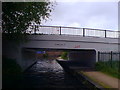
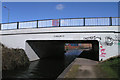
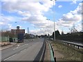
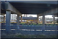
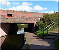
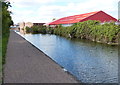
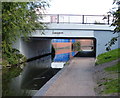
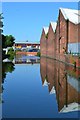
Photos of B24 9PF
Area Information
Living in B24 9PF means inhabiting a compact, residential postcode cluster in Erdington, Birmingham, where history and modernity intersect. The area, known as Pype Hayes, sits along the ancient Welsh Road (now Chester Road) and is home to 1,615 residents in a densely populated 844 people per square kilometre. This small but distinct area blends inter-war semi-detached housing with later developments, offering a suburban feel within a city context. Its name traces back to Henry de Pipe, whose 17th-century hall was later repurposed as a public space, now part of Pype Hayes Park. Daily life here is shaped by proximity to schools, transport links, and a mix of private and council housing. While the area’s compact size means limited expansion, its established infrastructure and proximity to Birmingham’s core make it a pragmatic choice for those seeking a quieter residential environment without sacrificing connectivity.
- Area Type
- Postcode
- Area Size
- Not available
- Population
- 1615
- Population Density
- 844 people/km²
The property market in B24 9PF is characterised by a 49% home ownership rate, indicating a significant portion of the housing stock is rented. The accommodation type is predominantly houses, many of which date back to the inter-war period, with semi-detached designs forming a notable feature. This mix of older and newer developments suggests a varied housing stock, though the small area size limits the range of property types available. The presence of both private and council housing means buyers may find a balance between owner-occupied homes and rental properties, though the latter may dominate in areas with higher rental demand. For those seeking homes in B24 9PF, the focus on houses rather than flats or apartments means the market caters more to families or those preferring standalone properties. The area’s compact nature also means buyers should consider proximity to local amenities and transport links when evaluating property value.
House Prices in B24 9PF
Showing 6 properties
| Address | Type | Beds | Baths | Last Sale Price | Last Sale Date | |
|---|---|---|---|---|---|---|
| Apartment 6, 1 Manor Way, Birmingham, B24 9PF | Flat | - | - | - | - | |
| Apartment 3, 1 Manor Way, Birmingham, B24 9PF | Flat | - | - | - | - | |
| Apartment 1, 1 Manor Way, Birmingham, B24 9PF | Flat | - | - | - | - | |
| Apartment 5, 1 Manor Way, Birmingham, B24 9PF | Flat | - | - | - | - | |
| Apartment 2, 1 Manor Way, Birmingham, B24 9PF | Flat | - | - | - | - | |
| Apartment 4, 1 Manor Way, Birmingham, B24 9PF | Flat | - | - | - | - |
Energy Efficiency in B24 9PF
Residents of B24 9PF have access to a range of retail, dining, and transport amenities within practical reach. Local shops include Lidl Tyburn, Farmfoods Erdington, and Aldi Chester, providing everyday grocery needs. The area’s rail and metro stations, such as Erdington and St Paul’s, offer convenient links to Birmingham’s core, while Pype Hayes Park offers recreational space derived from the historic Pype Hayes Hall. The mix of retail and transport options supports a lifestyle that balances convenience with suburban tranquillity. However, the absence of major leisure venues or dining hubs within the immediate area means residents may need to travel for more specialised services. The compact nature of B24 9PF ensures that daily errands and commuting are manageable, though those seeking a wider array of cultural or entertainment options may need to look beyond the postcode.
Amenities
Schools
Residents of B24 9PF have access to multiple primary schools, including Birches Green Infant School, Birches Green Junior School, and Birches Green Primary School, with some operating as academies. These institutions provide a range of educational options, though specific Ofsted ratings are not provided in the data. The presence of both traditional primary schools and academies suggests a mix of governance models, which may appeal to families seeking different educational approaches. While the data does not specify academic performance or student outcomes, the concentration of schools in the area indicates a focus on local education infrastructure. For families, this proximity to multiple schools reduces commuting times and ensures a choice of schooling options. However, the lack of secondary schools in the immediate vicinity may require consideration of nearby districts for older students.
| Rank | School | Type | Entry gender | Ages |
|---|
Explore more schools in this area
Go to Schools tabDemographics
The community in B24 9PF is predominantly composed of adults aged 30–64, with a median age of 47. This suggests a mature, settled population, likely with established careers and families. Home ownership stands at 49%, indicating a mix of owner-occupied properties and rental tenancies. The accommodation type is primarily houses, reflecting a suburban layout rather than high-density living. The predominant ethnic group is White, though specific diversity metrics are not provided. The age profile and home ownership rate suggest a stable demographic with long-term residency patterns. However, the lack of detailed data on deprivation or income levels means the area’s economic diversity remains less defined. For buyers, this profile implies a community focused on family life and long-term housing needs, with a balance between private and public housing options.
Household Size
Accommodation Type
Tenure
Ethnic Group
Religion
Household Composition
Age
Household Deprivation
NS-SEC
Explore more demographic insights in this area
Go to Demographics tabPlanning
Planning Constraints
- Flood RiskPremium
- Ramsar Wetland SitesPremium
- Area of Outstanding Natural BeautyPremium
- Protected Nature ReservePremium
- Protected WoodlandPremium