Area Overview for B24 9JT
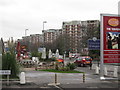
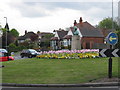
Photos of B24 9JT


Area Information
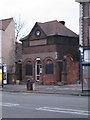
Living in B24 9JT means being part of a small, tightly knit residential cluster in Erdington, a historic suburb of Birmingham. The area, with a population of 1,495, sits near the River Tame and Chester Road, a former Roman route. Its character stems from its origins as a village, evolving into a suburban hub with a main retail strip at Erdington High Street, one of Birmingham’s largest shopping districts. The community is predominantly middle-aged, with a median age of 47, and households are largely owner-occupied, at 59%. This suggests a stable, long-term resident base. Daily life is shaped by proximity to amenities like supermarkets, rail stations, and parks, while the area’s low flood risk and moderate crime score (46/100) balance practical concerns with a sense of normality. For buyers, B24 9JT offers a quiet, established environment with easy access to Birmingham’s transport network and a heritage steeped in local history, from Roman roads to Victorian-era development.
- Area Type
- Postcode
- Area Size
- Not available
- Population
- 1495
- Population Density
- 5456 people/km²
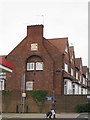
The property market in B24 9JT is dominated by owner-occupied homes, with 59% of properties owned outright. This contrasts with areas where rental demand drives the market, indicating a focus on long-term residency. The accommodation type is primarily houses, which are more common than flats or apartments in this postcode. This suggests a family-oriented housing stock, with larger properties typical of suburban areas. Given the small size of the area and its proximity to Erdington High Street, property values may reflect the desirability of local amenities and transport links. Buyers should consider that the limited housing stock means competition may be higher for specific properties, particularly those near key services like retail hubs or rail stations.
House Prices in B24 9JT
No properties found in this postcode.
Energy Efficiency in B24 9JT
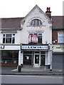
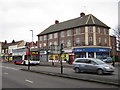
Residents of B24 9JT have access to a range of amenities within practical reach. The retail sector includes major supermarkets like Lidl BIR Erdington 2, Tesco Erdington, and Co-op High, ensuring everyday shopping needs are met. Transport links are robust, with five rail stations and five metro stops nearby, including Erdington Railway Station and St Paul’s Metro stop. Parks and green spaces are also accessible, such as Rookery Park (former district offices) and Brookvale Park Lake, offering recreational opportunities. The area’s historical character is complemented by modern conveniences, with Erdington High Street serving as a commercial hub. This mix of retail, transport, and green space creates a balanced lifestyle, blending suburban tranquillity with urban accessibility.
Amenities
Schools
| Rank | School | Type | Entry gender | Ages |
|---|
Explore more schools in this area
Go to Schools tabDemographics
The community in B24 9JT is defined by its age profile, with a median age of 47 and the majority of residents falling into the 30–64 age range. This suggests a population skewed towards adults, likely including families and professionals. Home ownership is strong, at 59%, indicating a stable, long-term demographic. The area is predominantly occupied by houses, which aligns with the residential character of the postcode. The predominant ethnic group is White, though no specific diversity statistics are provided. This age group and ownership rate imply a community focused on settled living, with fewer transient populations. The absence of data on deprivation or income levels means the area’s economic profile remains unclear, but the high home ownership rate suggests a degree of financial stability.
Household Size
Accommodation Type
Tenure
Ethnic Group
Religion
Household Composition
Age
Household Deprivation
NS-SEC
Explore more demographic insights in this area
Go to Demographics tabPlanning
Planning Constraints
- Flood RiskPremium
- Ramsar Wetland SitesPremium
- Area of Outstanding Natural BeautyPremium
- Protected Nature ReservePremium
- Protected WoodlandPremium