Area Overview for B24 9HZ
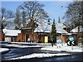
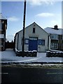
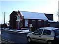
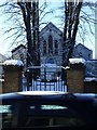
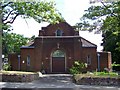
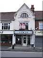
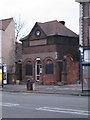
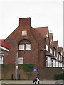
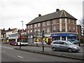
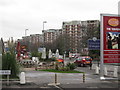
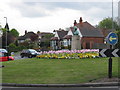
Photos of B24 9HZ
Area Information
Living in B24 9HZ means being part of a small, residential cluster in Erdington, a suburb of Birmingham with a distinct character rooted in its history. The area’s population of 1,820 reflects a tight-knit community, with homes primarily occupied by adults aged 30–64. Centred around the River Tame and historic Chester Road, the area has evolved from a medieval village into a modern suburb with a main shopping district at Erdington High Street. Daily life here balances convenience with a sense of local identity, supported by nearby amenities and transport links. The postcode’s proximity to Birmingham’s core, combined with its low flood risk and access to rail networks, makes it a practical choice for those seeking a suburban lifestyle without sacrificing connectivity. While the area lacks the density of urban centres, its charm lies in its manageable scale and historical ties to the region’s development. For buyers, B24 9HZ offers a snapshot of a community that prioritises stability, with homes and services tailored to a mature demographic.
- Area Type
- Postcode
- Area Size
- Not available
- Population
- 1820
- Population Density
- 4444 people/km²
The property market in B24 9HZ is characterised by a low home ownership rate of 25%, suggesting that the majority of residents rent their homes. The accommodation type is primarily houses, which are typically associated with family living. This mix indicates a market that caters more to renters than buyers, though the presence of houses may appeal to those seeking larger, more permanent residences. Given the area’s small size and limited data on property prices or availability, the market likely operates within a constrained local context. Buyers should consider the rental-heavy nature of the area, which may affect long-term investment potential. The focus on houses also implies that the housing stock is not dominated by flats or apartments, aligning with the suburban profile of Erdington.
House Prices in B24 9HZ
No properties found in this postcode.
Energy Efficiency in B24 9HZ
Daily life in B24 9HZ is enriched by a mix of retail, leisure, and green spaces. The area’s retail offerings include Lidl BIR Erdington 2 and Co-op High, providing essential shopping options. Nearby parks and open spaces, such as Rookery Park—once the district’s administrative heart—and Brookvale Park Lake, offer recreational opportunities. The historic Erdington High Street serves as a focal point for local shopping, while the Birmingham Fazeley Canal adds a scenic element to the area’s landscape. The presence of rail and metro stations, including Erdington Railway Station and St Chads, ensures easy access to Birmingham’s cultural and commercial hubs. This blend of practical amenities and natural spaces supports a lifestyle that balances convenience with a connection to the region’s heritage.
Amenities
Schools
Residents of B24 9HZ have access to a range of educational institutions, including Osborne Nursery School, which provides early years education, and Osborne Primary School, rated ‘good’ by Ofsted. For independent schooling, Highclare School and Imedia School—rated ‘outstanding’—offer alternative options. The presence of both state and independent schools reflects a diverse educational landscape, catering to different preferences and needs. Families seeking state-funded education can rely on the ‘good’-rated primary school, while those prioritising independent education have access to high-performing institutions. The variety of school types ensures that parents can choose between traditional public schooling and the resources of private education. This mix supports a community that values both accessibility and academic excellence in education.
| Rank | A + A* % | School | Type | Entry gender | Ages |
|---|---|---|---|---|---|
| 1 | N/A | Osborne Nursery School | nursery | N/A | N/A |
| 2 | N/A | Osborne Primary School | primary | N/A | N/A |
| 3 | N/A | Highclare School | independent | N/A | N/A |
| 4 | N/A | Imedia School | independent | N/A | N/A |
| 5 | N/A | Osborne Primary School | primary | N/A | N/A |
Explore more schools in this area
Go to Schools tabDemographics
The population of B24 9HZ is predominantly adults aged 30–64, with a median age of 47. This suggests a community of middle-aged residents, likely including families and professionals. Home ownership in the area is low, with only 25% of households owning their homes, indicating a rental market that dominates. The accommodation type is primarily houses, which aligns with the area’s suburban character. The predominant ethnic group is White, reflecting the broader demographic trends in Birmingham’s outer suburbs. While the data does not specify deprivation levels, the low home ownership rate may suggest a reliance on rental properties, which could influence the local economy and housing dynamics. The absence of detailed diversity statistics means the community’s full composition remains less defined, but the age profile and housing stock point to a stable, if relatively homogenous, population.
Household Size
Accommodation Type
Tenure
Ethnic Group
Religion
Household Composition
Age
Household Deprivation
NS-SEC
Explore more demographic insights in this area
Go to Demographics tabPlanning
Planning Constraints
- Flood RiskLocked
- Ramsar Wetland SitesLocked
- Area of Outstanding Natural BeautyLocked
- Protected Nature ReserveLocked
- Protected WoodlandLocked
- Crime RiskLocked