Area Overview for B24 9HN
Photos of B24 9HN
Area Information
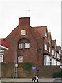
Living in B24 9HN means being part of a small, tightly knit residential cluster in Erdington, a suburb of Birmingham. The area has a population of 1,820, reflecting its compact nature. Historically, Erdington developed around the River Tame and Roman roads, evolving into a suburban hub with a main shopping district at Erdington High Street. Today, the postcode covers parts of Six Ways and Wylde Green, areas with a mix of older housing stock and modern developments. Daily life here is shaped by proximity to local amenities, schools, and transport links. The area’s character blends historical roots with practical modern living, offering a quieter alternative to Birmingham’s city centre while remaining connected to its infrastructure. Residents benefit from nearby rail and metro stations, as well as a range of retail options. The community is defined by its accessibility to both urban and semi-rural environments, making it a viable choice for those seeking a balance between convenience and tranquillity.
- Area Type
- Postcode
- Area Size
- Not available
- Population
- 1820
- Population Density
- 4444 people/km²
The property market in B24 9HN is characterised by a 25% home ownership rate, which is notably lower than the national average. This suggests that the area is more reliant on rental properties than owner-occupied homes. The predominant accommodation type is houses, though the exact number of flats or other property types is not specified. Given the small size of the postcode area, the housing stock is likely limited in volume, which could make the market competitive for buyers. The low home ownership rate may reflect economic factors, such as affordability challenges or a preference for renting in a suburban setting. For buyers, this means the area may not offer a wide range of options, and those seeking property here should consider the limited supply and potential competition from both local and external investors.
House Prices in B24 9HN
No properties found in this postcode.
Energy Efficiency in B24 9HN
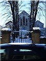
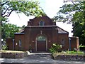
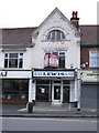
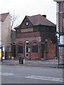
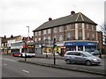
Residents of B24 9HN have access to a range of amenities within practical reach. The retail sector includes stores such as Lidl BIR Erdington 2, Co-op High, and Heron Erdington, offering everyday shopping needs. Transport options are robust, with rail stations like Erdington Railway Station and Chester Road Railway Station, as well as metro stops at St Chads and Bull Street, ensuring connectivity to Birmingham and beyond. Parks and green spaces, such as Rookery Park (former district offices) and Brookvale Park Lake (a former reservoir), provide recreational opportunities. The area’s historical and cultural landmarks, including St Barnabas Church and Erdington Library, add to its character. These amenities collectively support a balanced lifestyle, combining convenience with access to nature and community facilities.
Amenities
Schools
The schools near B24 9HN include Osborne Nursery School, Osborne Primary School (rated ‘good’ by Ofsted), Highclare School, and Imedia School (rated ‘outstanding’). The presence of both state and independent schools offers families flexibility in choosing education options. Osborne Primary School’s ‘good’ rating indicates a reliable foundation for early education, while Imedia School’s ‘outstanding’ rating suggests high academic standards and resources. Highclare School, an independent institution, may cater to specific educational preferences or fee-paying families. The mix of school types ensures that residents have access to a range of educational pathways, from state-funded primary education to private schooling. This diversity can be advantageous for families seeking tailored learning environments or seeking to align with particular curricula or values.
| Rank | School | Type | Entry gender | Ages |
|---|
Explore more schools in this area
Go to Schools tabDemographics
The median age in B24 9HN is 47, with the majority of residents falling into the 30–64 age range. This suggests a community of established adults, many of whom may be in their prime working years. Home ownership rates are low at 25%, indicating a higher proportion of renters compared to owner-occupiers. The predominant accommodation type is houses, though the exact distribution of household types is not specified. The predominant ethnic group is White, which aligns with broader demographic trends in the area. While no specific deprivation data is provided, the low home ownership rate could imply economic diversity, with some residents relying on rental income or alternative housing models. The age profile suggests a stable, mature population, though the lack of data on younger demographics or family structures limits deeper analysis of the community’s composition.
Household Size
Accommodation Type
Tenure
Ethnic Group
Religion
Household Composition
Age
Household Deprivation
NS-SEC
Explore more demographic insights in this area
Go to Demographics tabPlanning
Planning Constraints
- Flood RiskPremium
- Ramsar Wetland SitesPremium
- Area of Outstanding Natural BeautyPremium
- Protected Nature ReservePremium
- Protected WoodlandPremium