Area Overview for B24 9EZ
Photos of B24 9EZ
Area Information
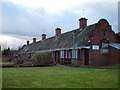
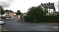
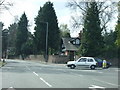
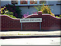
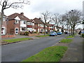
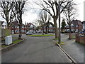
Living in B24 9EZ, a small residential cluster in Birmingham’s Erdington area, offers a blend of suburban tranquillity and proximity to urban amenities. With a population of 1,495, the area is compact yet connected, centred around historical landmarks like the River Tame and Chester Road, a former Roman route. Erdington itself evolved from a medieval village into a Birmingham suburb, with a main retail hub at Erdington High Street. The area’s character is shaped by its mix of older homes and modern developments, such as Sorrel House in Pype Hayes. Residents benefit from easy access to transport networks, including rail and metro stations, and a range of local shops and services. While the community is small, it is integrated into the broader Birmingham infrastructure, offering a balance between residential comfort and urban convenience. The postcode’s low flood risk and absence of protected natural sites suggest a stable environment, though crime rates are average, requiring standard security measures. For those seeking a self-contained yet connected lifestyle, B24 9EZ provides a distinct slice of West Midlands living.
- Area Type
- Postcode
- Area Size
- Not available
- Population
- 1495
- Population Density
- 5456 people/km²
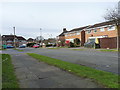
The property market in B24 9EZ is characterised by a high proportion of owner-occupied homes, with 59% of residents owning their properties. This suggests a stable, long-term demographic with a focus on residential permanence rather than rental turnover. The accommodation type is predominantly houses, which is unusual for a small postcode area but aligns with the broader Erdington region’s suburban development. This housing mix may appeal to families seeking space and privacy, though the limited size of the area means housing options are constrained. For buyers, the market likely reflects a balance between older, established homes and newer developments like Sorrel House in Pype Hayes. The absence of significant rental activity implies that property values may be influenced by local demand and proximity to Birmingham’s urban amenities. Prospective buyers should consider the area’s compact nature and the potential for limited expansion in the immediate vicinity.
House Prices in B24 9EZ
No properties found in this postcode.
Energy Efficiency in B24 9EZ
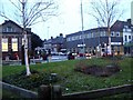
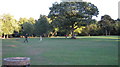
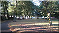
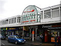
Residents of B24 9EZ have access to a range of local amenities within walking or short driving distance. Retail options include Lidl BIR Erdington 2, Co-op High, and Heron Erdington, providing everyday shopping needs. The area’s transport links, such as Erdington Railway Station and St Chads metro stop, connect residents to Birmingham’s broader network, facilitating access to cultural, professional, and leisure opportunities. Nearby parks and open spaces, like Rookery Park (former district offices) and Brookvale Park Lake, offer recreational space for walking or relaxation. The historical character of the area is complemented by facilities such as Erdington Library and St Barnabas Church, adding to the community’s distinct identity. While the postcode’s small size limits the diversity of amenities, the proximity to Erdington High Street ensures a convenient, self-contained lifestyle.
Amenities
Schools
| Rank | School | Type | Entry gender | Ages |
|---|
Explore more schools in this area
Go to Schools tabDemographics
The community in B24 9EZ is predominantly composed of adults aged 30–64, with a median age of 47. This suggests a mature, established population, likely with long-term ties to the area. Home ownership is high at 59%, indicating a stable residential base with a focus on property retention. The accommodation type is primarily houses, reflecting a suburban or semi-rural character, though the area’s small size means this housing stock is concentrated. The predominant ethnic group is White, which aligns with broader demographic trends in the West Midlands. While no specific data on deprivation is provided, the age profile and home ownership rates imply a community with relatively stable economic conditions. The absence of detailed diversity metrics means the area’s social composition remains largely unexplored in the data, but the focus on adult residents and owner-occupation points to a settled, family-oriented demographic.
Household Size
Accommodation Type
Tenure
Ethnic Group
Religion
Household Composition
Age
Household Deprivation
NS-SEC
Explore more demographic insights in this area
Go to Demographics tabPlanning
Planning Constraints
- Flood RiskPremium
- Ramsar Wetland SitesPremium
- Area of Outstanding Natural BeautyPremium
- Protected Nature ReservePremium
- Protected WoodlandPremium