Area Overview for B24 9DR
Photos of B24 9DR


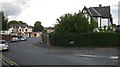
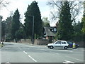
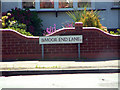
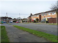
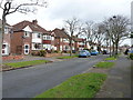
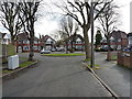
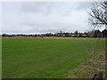
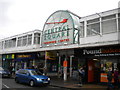
44 photos from this area
Area Information
Key information about the B24 9DR including its size, population, and administrative classification.
- Area Type
- Postcode
- Area Size
- 2.2 hectares
- Population
- 1495
- Population Density
- 5456 people/km²
House Prices in B24 9DR
68
Properties
£141,841
Average Sold Price
£47,000
Lowest Price
£275,000
Highest Price
Showing 68 properties
| Address | Type | Beds | Baths | Last Sale Price | Last Sale Date | |
|---|---|---|---|---|---|---|
| 206 Moor End Lane, Birmingham, B24 9DR | Terraced | 4 | 2 | £275,000 | Jul 2025 | |
| 152 Moor End Lane, Birmingham, B24 9DR | house | 3 | 1 | £259,950 | Jun 2020 | |
| 200 Moor End Lane, Birmingham, B24 9DR | Terraced | 4 | 2 | £242,000 | Dec 2019 | |
| 150 Moor End Lane, Birmingham, B24 9DR | Detached | 3 | 1 | £175,000 | Aug 2016 | |
| 202 Moor End Lane, Birmingham, B24 9DR | Terraced | 4 | 1 | £172,500 | Nov 2015 | |
| 158 Moor End Lane, Birmingham, B24 9DR | Bungalow | - | - | £165,500 | Oct 2014 | |
| 230 Moor End Lane, Birmingham, B24 9DR | Bungalow | 3 | - | £177,500 | Sep 2012 | |
| 140 Moor End Lane, Birmingham, B24 9DR | house | - | - | £100,000 | Dec 2010 | |
| 144 Moor End Lane, Birmingham, B24 9DR | house | - | - | £152,000 | Jan 2010 | |
| 148 Moor End Lane, Birmingham, B24 9DR | Terraced | - | - | £165,000 | Apr 2007 |
Page 1 of 7
Energy Efficiency in B24 9DR
Amenities
Schools
| Rank | School | Type | Entry gender | Ages |
|---|
Explore more schools in this area
Go to Schools tabDemographics
Household Size
One person
most common
Accommodation Type
Houses
most common
Tenure
59
majority
Ethnic Group
White
most common
Religion
N/A
most common
Household Composition
N/A
most common
Age
47
median
Adults (30-64 years)
most common
Household Deprivation
N/A
with no deprivation
NS-SEC
34
in Lower managerial occupations
Explore more demographic insights in this area
Go to Demographics tabPlanning
Planning Constraints
- Flood RiskPremium
- Ramsar Wetland SitesPremium
- Area of Outstanding Natural BeautyPremium
- Protected Nature ReservePremium
- Protected WoodlandPremium