Area Overview for B24 9AF
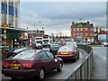
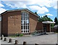
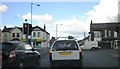
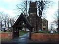
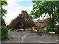
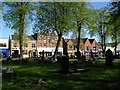
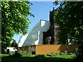
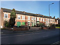
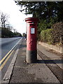
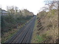
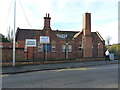
Photos of B24 9AF

Area Information
Living in B24 9AF means being part of a small, tightly knit residential cluster in England’s West Midlands. With a population of 2,017, this area is characterised by its historical roots as a village near the River Tame, evolving into a suburban hub of Birmingham. The community is predominantly composed of adults aged 30–64, with a median age of 47, reflecting a mature demographic. The area’s compact size fosters a sense of familiarity, with local landmarks such as Erdington High Street offering a third of Birmingham’s retail space. Residents benefit from proximity to historical sites like Erdington Hall and modern amenities like Rookery Park. While the area lacks natural beauty designations, its strategic location near transport routes and retail hubs makes it practical for daily life. The mix of older homes and recent developments, combined with a strong sense of local identity, defines B24 9AF as a place where tradition meets convenience.
- Area Type
- Postcode
- Area Size
- Not available
- Population
- 2017
- Population Density
- 5738 people/km²
B24 9AF is a predominantly owner-occupied area, with 47% of residents owning their homes. The housing stock is largely composed of houses, which is unusual for a postcode area of this size, suggesting a focus on single-family dwellings rather than apartments or flats. This configuration may appeal to families seeking space and privacy, though the limited number of properties indicates a small, tightly held market. The area’s compact nature means buyers should consider nearby suburbs for more options. The absence of high-rise buildings or rental-focused developments suggests a quieter, more residential character. For those prioritising home ownership, B24 9AF offers a stable environment, but the limited supply could mean competition for available properties. The emphasis on houses also implies lower density, which may be a consideration for buyers seeking proximity to urban amenities.
House Prices in B24 9AF
No properties found in this postcode.
Energy Efficiency in B24 9AF
Daily life in B24 9AF is shaped by its retail and transport networks. The area’s five retail venues, including Farmfoods Erdington and Iceland, provide essential shopping options. Nearby railway stations such as Erdington and Gravelly Hill, along with metro stops like St Chads, ensure easy access to Birmingham’s urban core. The presence of multiple transport links enhances mobility, whether for commuting or leisure. While the data does not mention parks or leisure facilities, the area’s historical retail district, Erdington High Street, remains a focal point for community activity. The blend of practical amenities and historical sites creates a lifestyle that balances convenience with a sense of local heritage. Residents can enjoy a mix of modern shopping and traditional transport routes, making daily routines efficient and connected.
Amenities
Schools
Residents of B24 9AF have access to Queensbury School, listed twice in the data as a special school. While this duplication may indicate an error, the presence of two special schools suggests a focus on tailored education for students with specific needs. The area’s schools are not explicitly rated, but the availability of a special school indicates a commitment to supporting diverse educational requirements. Families with children requiring specialist provision may find this a key advantage. However, the absence of mainstream schools or secondary institutions in the data means the full range of educational options cannot be assessed. Prospective buyers should investigate further to confirm the availability of schools catering to all age groups and academic needs.
| Rank | School | Type | Entry gender | Ages |
|---|
Explore more schools in this area
Go to Schools tabDemographics
The population of B24 9AF is predominantly adults aged 30–64, with a median age of 47. Home ownership stands at 47%, indicating a balanced mix of owner-occupied and rental properties. The area’s accommodation is primarily houses, suggesting a family-oriented housing stock. The predominant ethnic group is White, though no specific diversity metrics are provided. This demographic profile implies a community with established roots, where many residents have lived for years. The 47% home ownership rate suggests a stable market with a significant proportion of long-term residents. However, the lack of data on deprivation means the quality of life cannot be fully assessed beyond the provided statistics. The age range and housing type indicate a focus on family living, with fewer younger or elderly residents compared to other areas.
Household Size
Accommodation Type
Tenure
Ethnic Group
Religion
Household Composition
Age
Household Deprivation
NS-SEC
Explore more demographic insights in this area
Go to Demographics tabPlanning
Planning Constraints
- Flood RiskPremium
- Ramsar Wetland SitesPremium
- Area of Outstanding Natural BeautyPremium
- Protected Nature ReservePremium
- Protected WoodlandPremium